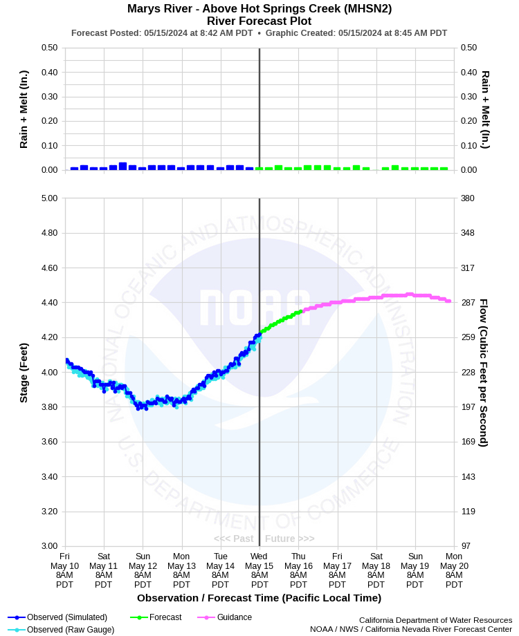
| MARYS RIVER - ABOVE HOT SPRINGS CREEK (MHSN2) | ||
| Latitude: 41.25º N | Longitude: 115.26º W | Elevation: 5504 Feet |
| Location: Elko County in NV | ||
| River Group: Humboldt | ||
| Forecast Issued: | Apr 25 2024 at 8:23 AM PDT | Next Issuance: | Apr 26 2024 at 9:00 AM PDT |
| Monitor Stage: 5.5 Feet | Flood Stage: 6.0 Feet |
Prev. Point | Next Point | Tabular |
Back to Points | Back to Home | Ensemble Fcst |
 |
Historical Stage/Flow Data |
|||
|
Water Year
|
Peak Discharge (cfs)
|
Stage (feet)
|
Date
|
| Most Recent 5 Years | |||
2022* |
179 |
4.38 |
May 30, 2022 |
2021* |
91 |
3.86 |
May 23, 2021 |
2020* |
329 |
5.24 |
May 4, 2020 |
2019* |
624 |
6.56 |
Jun 2, 2019 |
2018* |
174 |
3.95 |
May 28, 2018 |
| Historical High Stage/Flow Events (Period of Record - Oct 1943-Sep 1980 and Oct 1981 to Present) - Ranked by Flow | |||
1962* |
4,210 |
7.63 |
Feb 12, 1962 |
1984* |
2,110 |
8.39 |
May 15, 1984
|
2006* |
1,330 |
3.24 |
Apr 17, 2006 |
| 1952* |
1,250 |
6.57 |
Apr 29, 1952
|
| * Discharge affected to unknown degree by regulation or diversion | |||
| Location Photographs | ||
| ESRI™ Locator Map |
| Impacts - E19 Information | |
| 6.0 Feet | Minor lowland flooding on Lower Marys River. Minor flooding of rural roads throughout area. Some minor flooding of streets in Deeth. |
| 6.8 Feet | Minor to moderate lowland flooding on Lower Marys River. Flooding of many rural roads near river. Some streets in Deeth flooded with basements and foundations of a few homes flooded. |
| 7.6 Feet | Moderate lowland flooding on Lower Marys River with moderate damage to roads, railroads, and structures in floodplain. Cattle subject to miring and drowning. Many streets in Deeth flooded with basements and foundations of some homes flooded. (Similar to flood of May 20, 2005) |
| 8.4 Feet | Moderate to major flooding on Lower Marys River with significant damage to roads, railroads, and structures in floodplain. Cattle subject to miring and drowning. Much of the lower portion of Deeth is inundated with many basements and foundations of homes flooded. (Similar to flood of May 15, 1984) |
| 9.0 Feet | Major flooding on Lower Marys River with many homes in low-lying sections of Deeth sustaining damage. Transportation and communication in area severely disrupted. Major damage to roads, railroads, and structures in floodplain. Water over a foot deep on some roads and railroads. Cattle subject to drowning. Sever erosion and sediment damage throughout reach. (Similar to record flood of February 12, 1962) |