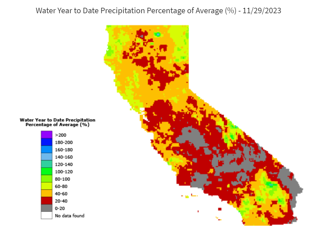
Water year 2024 has started off drier than average. As of Nov 30th, the Northern Sierra 8-station index is 48% of normal, SanJoaquin index is 35%, and Tulare is 31%. The statewide precipitation is 50% of normal (based on the 1981-current period of record). Below is the statewide percent of normal precipitation graphic from the California Water Watch website.
*source CA Department of Water Resources
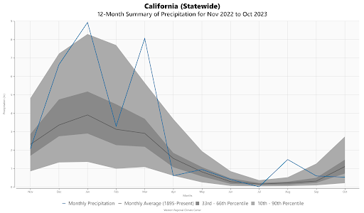
Even though we’ve started off dry this water year, the soil moisture is still generally tracking near normal to slightly above normal for much of the high elevation Sierra. This is partly due to the massive snowpack resulting in a long melt season, but also due to the very wet August (mainly due to Tropical Storm Hilary). Below is a statewide graphic showing monthly precipitation compared to historical percentiles for the past 12 months. The August precipitation was quite anomalous, and ranked the second wettest in 129 years.
*source Western Regional Climate Center
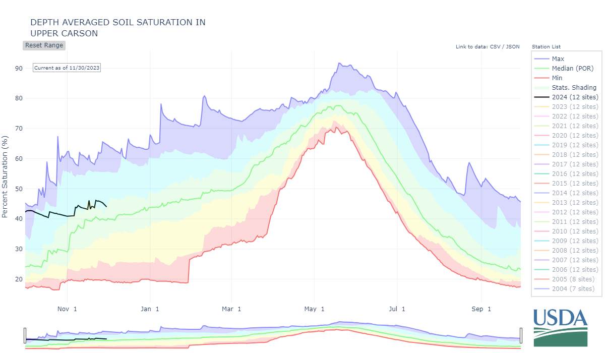
Based on the NRCS soil sensors, the Upper Carson is still showing slightly above normal for this time of year (see below). This is pretty consistent with the CNRFC soil models. Much of the CNRFC high elevation soil models are showing 100 to 150 percent of normal for the Central and Southern Sierra, and 100 to 125 percent of normal for the Northern Sierra.
*source NRCS
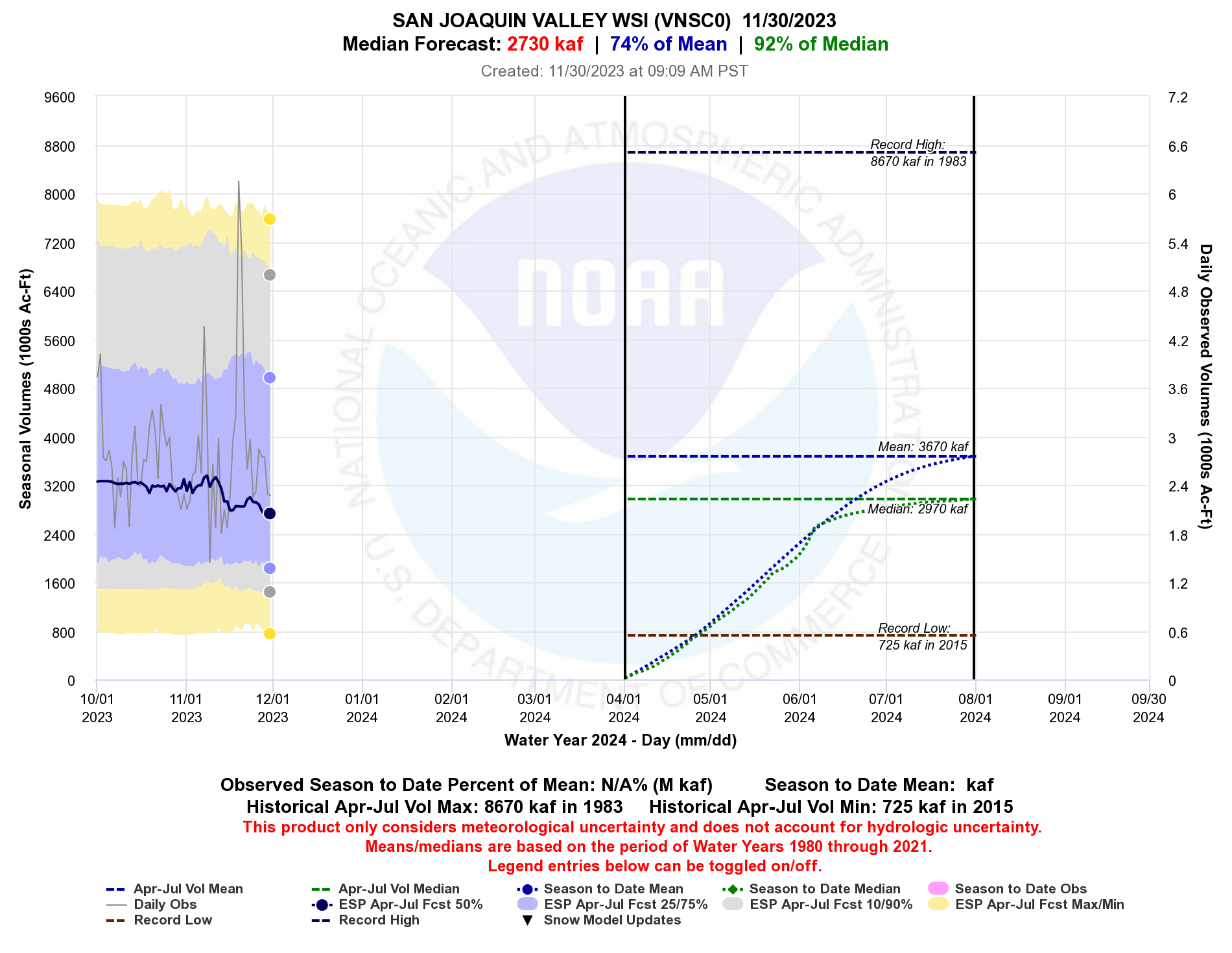
Due to the dry start, the seasonal runoff forecasts have been slowly dropping over the past couple of months. October-November is not typically that wet, so there have not been significant drops in the long range seasonal runoff forecasts, but the drop is noticeable. The San Joaquin River Index seasonal volume forecast has dropped about 530 KAF since the beginning of October (see below).
*source CNRFC
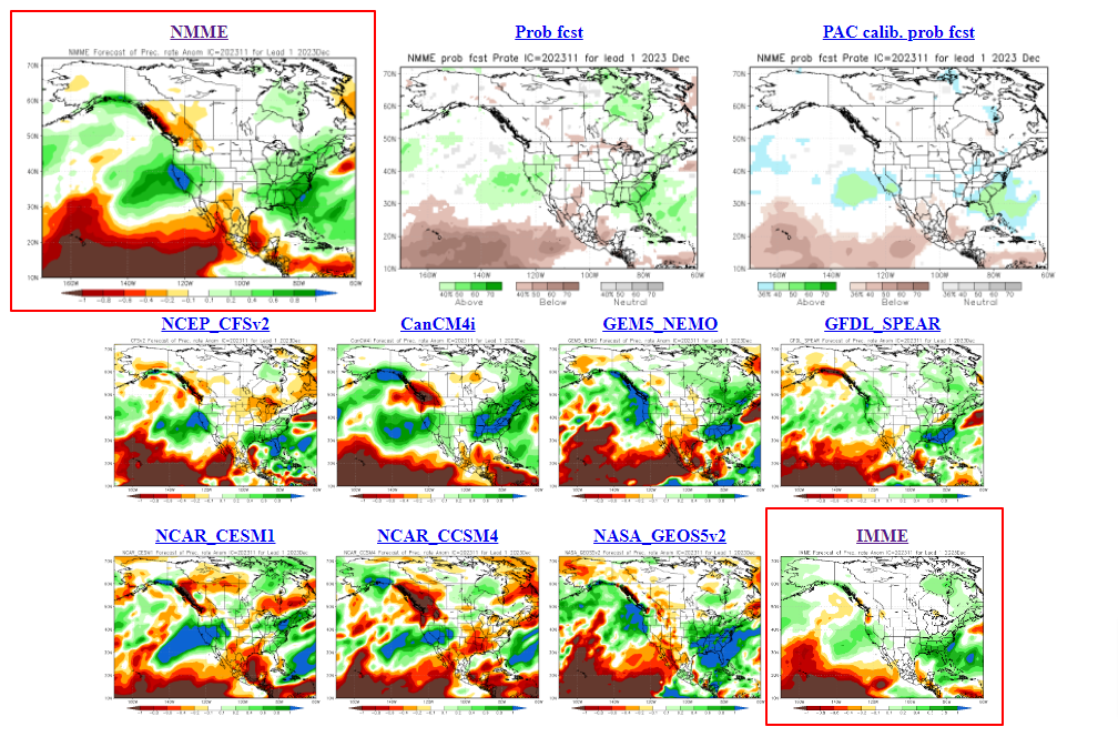
Looking into the future, the December forecasts were looking fairly wet at the beginning of November. When the National Multiple Model Ensemble (NMME) and the International Multiple Model Ensemble (IMME) products were issued near the beginning of November, they were both projecting above normal precipitation for most of CA (see red boxes below).
*source Climate Prediction Center
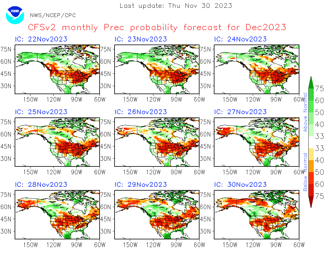
However, as we have progressed through November, the outlooks have been trending drier. The CFSv2, an ingredient in the NMME and the IMME, has been trending drier, and is currently projecting below normal precipitation for December
*source Climate Prediction Center
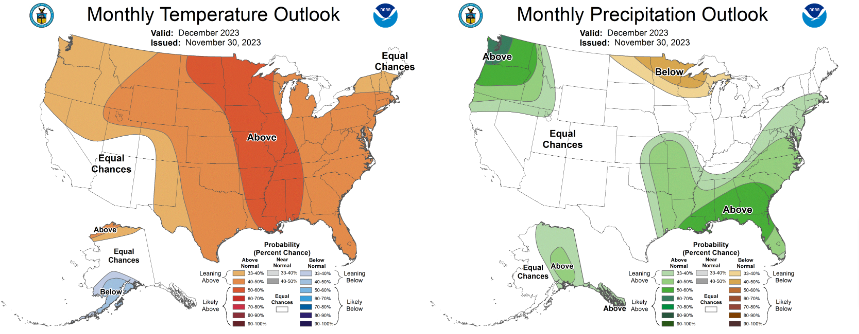
The Climate Prediction Center updated their projections for December yesterday, and is currently forecasting equal chances for most of CA and NV. As we all know, there is a lot of uncertainty in the longer range weather forecasts. Last December, many of the long range models were indicating below normal for January 2023, and we all know how that month ended up!
*source Climate Prediction Center