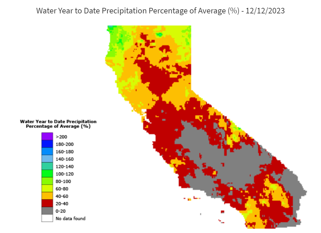
Conditions have remained on the dry side across much of the forecast area through the first half of December. The lone wet spot so far this winter has been along the north coast, where year-to-date precipitation is near normal. The rest of California remains well below normal, with much of the state less than 50% of average for this date.
Figure 1: Precipitation across California through Jan 12th. Source: CA Department of Water Resources
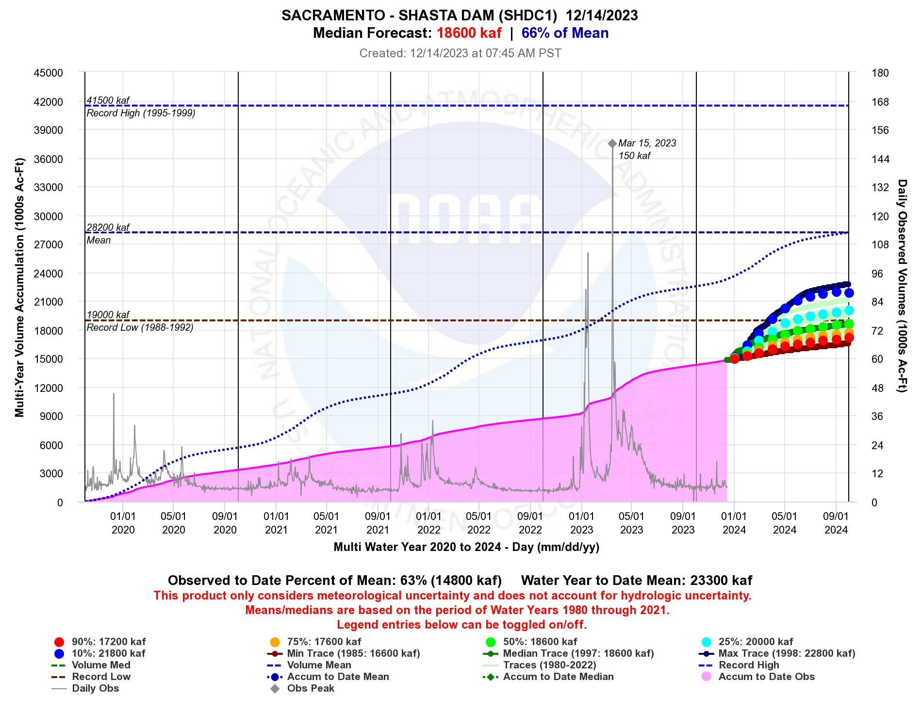
A new feature we introduced in our previous water supply email is the ability to select the accumulation period in our multi-year water accumulation plots. The user is now able to specify any accumulation period between 2 and 10 years. Using this enhancement ourselves revealed some interesting lingering drought impacts across the northern Sacramento River watershed and watersheds along the northern California coast. In Figure 2 below, you can see that despite the wet 2023 water year (WY), there is still roughly a 50% chance that Lake Shasta sets a new 5-year record low for accumulated volume. This highlights just how difficult it can be to dig out of a multi-year drought. Similar findings were revealed at Trinity Lake and reservoirs on the Russian River, though it is less likely those locations will set new 5-year accumulation record lows. Watersheds in the upper Sacramento and coastal watersheds were largely spared the brunt of the WY 2023 storms.
Figure 2: Forecasts for the 5-year accumulated volume at Shasta show roughly a 50% chance of setting a new record low (data period begins in WY 1951). Source: CNRFC
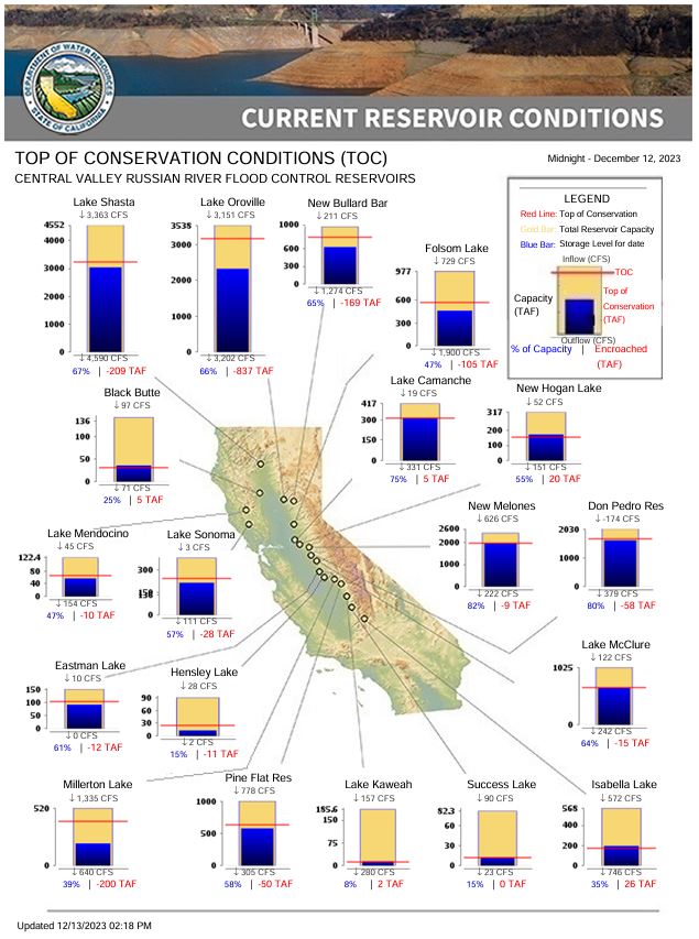
Despite the lack of rain across the region this WY, most California reservoirs are running above historical averages. Many of the reservoirs are currently at or near the top of the conservation pool, meaning they are at their maximum allowable storage for this time of year given the current conditions in the respective watersheds. Reservoirs across the Lower San Joaquin are in the best shape, with a few reservoirs across the north a bit drier, particularly Lake Oroville, which is running about 900,000 acre-feet below the top of the conservation pool.
Figure 3: Current storage at flood control reservoirs across the state of California. Source: CA Department of Water Resources
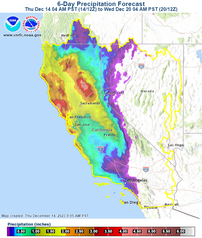
The time has come for skiers and water managers to rejoice, as a shift to a wetter weather pattern is expected to take place next week, possibly continuing through the remainder of December. The latest precipitation forecast from the CNRFC shows 6-day totals from 2-4in in the Sierra from the Feather River watershed southward through the American River watershed. Forecast precipitation begins to tail off south of Highway 50 through the southern Sierra. Snow levels will start out high, but are expected to settle in around 6-7,500ft near the I-80 corridor when the heavier precipitation moves through on Monday and Tuesday.
Figure 4: 6-day forecast precipitation totals showing 2-4in possible for the northern Sierra. Source: CNRFC
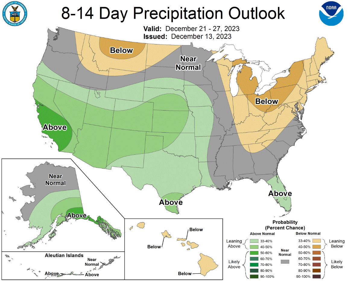
The 8-14 day forecast from the Climate Prediction Center (CPC) is currently highlighting increased chances for above normal precipitation for much of California, as shown in Figure 5. The southern half of the state is currently showing the highest probabilities for above normal precipitation. Forecasts from the CPC are also highlighting a moderate chance for heavy snow in the Sierra during the period from December 25-27th. A white, snowy Christmas in the Sierra? Current forecasts are leaning that direction.
Figure 5: 8-14 day forecast from the CPC highlighting increased chances for above average precipitation across much of California. Source: CPC
We will wrap up this water resources discussion with an El Niño update. In the most recent El Niño forecast discussion issued today, the CPC states that:
“Based on the latest forecasts, there is now a 54% chance of a “historically strong” El Niño during the November-January season (2.0C in Niño-3.4). An event of this strength would potentially be in the top 5 of El Niño events since 1950. While stronger El Niño events increase the likelihood of El Niño-related climate anomalies, it does not imply expected impacts will emerge in all locations or be of strong intensity.”
As I’m sure most of you reading this are aware, strong El Niño patterns have been linked to wetter than average conditions in the past for California. However, the record of strong El Niño patterns is a small sample size, and we all remember the disappointment that was the 2016 WY. As stated above from the CPC, a strong El Niño merely increases the likelihood of El Niño-related climate anomalies. No guarantees!
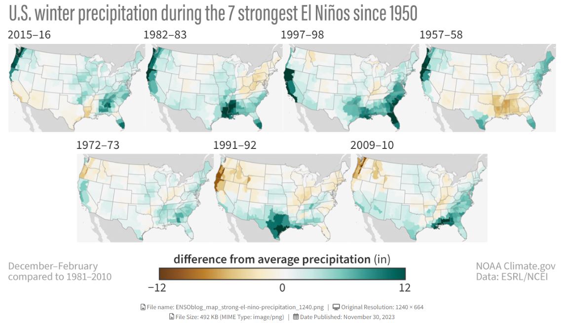
Figure 6 shows how past strong El Niño patterns have played out across the United States. If you would like more information on El Niño and its potential impacts on weather patterns, check out the latest discussion from the ENSO blog team.
Figure 6: Past strong El Niño patterns show an increased likelihood of wetter than average precipitation across California. Source: Climate.gov/ ENSO blog team