February precipitation during the first 11 days has been well above average.
Figure 1a February-to-date precipitation through February 12, 2024 at 4 AM PST. Source: CNRFC
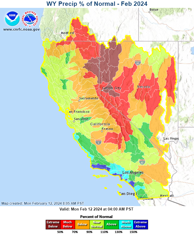
Rainfall during the first half of the water year has been focused on the coastal watersheds, with precipitation over the Sierra still running at only 70%-85% of average, and even less east of the Sierra crest.
Figure 1b WY-to-date precipitation through February 12, 2024 at 4 AM PST. Source: CNRFC
On Jan 31, Statewide water content stood at 8.3 inches. The first nine days of February brought the statewide value up to 13.5 inches, an increase of 63%.
Figure 2 CA snow water content by region. Source: CA Department of Water Resources
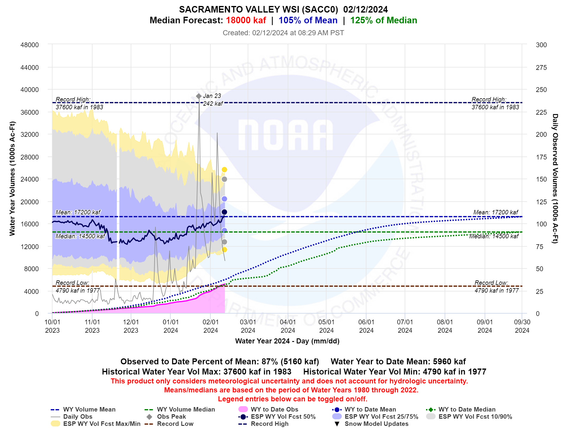
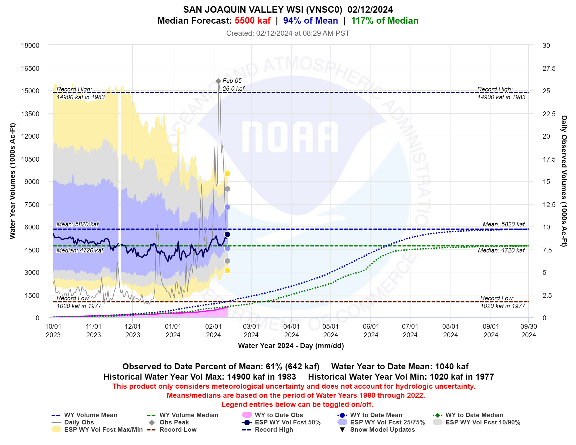
Trends in the water year forecasts for the Sacramento and San Joaquin Valley Water Resources Index locations are trending upward. Since Feb 8th, the HEFS predictions have been rising with the growing probability of wetter conditions beginning this weekend and into next week. Today the Sacramento Water Supply Index forecast reached above 100% of average for the first time this year.
Figure 3 Water year forecast trends for the Sacramento Valley Water Supply Index. Source: CNRFC
Figure 4 Water year forecast trends for the San Joaquin Valley Water Supply Index. Source: CNRFC
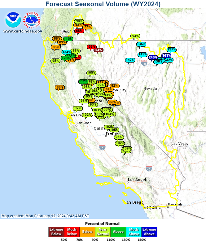
Figure 5 Seasonal (generally April through July) runoff forecasts. Source: CNRFC
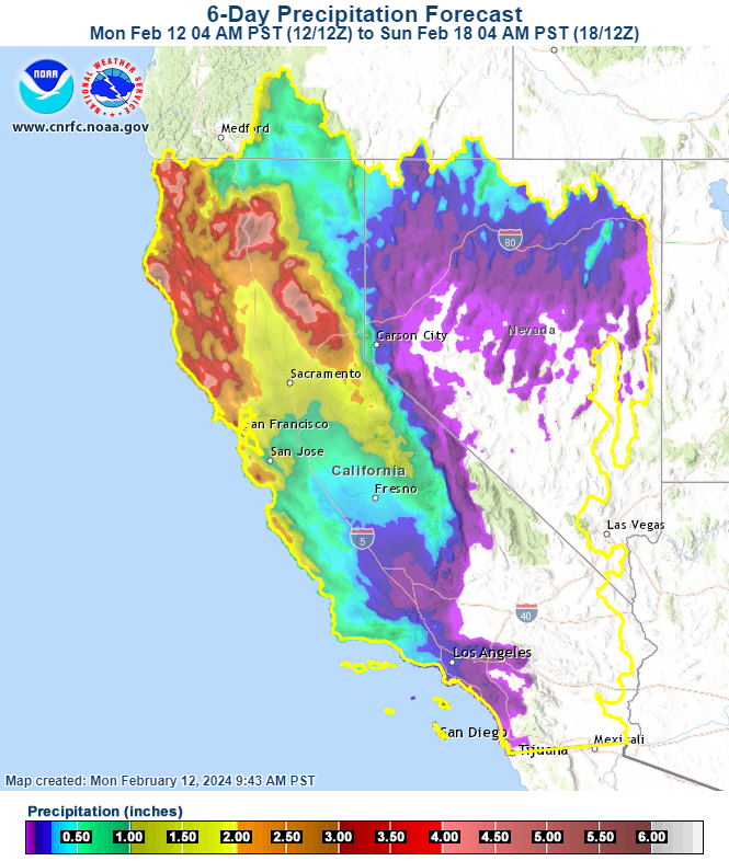
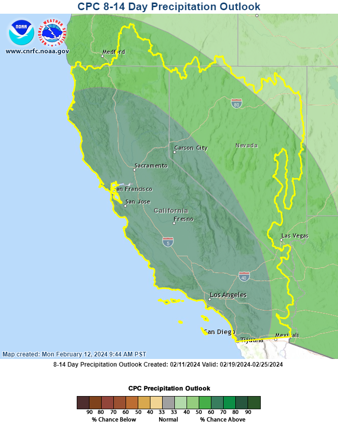
Forecasts show additional precipitation this week (next 6 days), with highest amounts in northern CA (figure 6a). Longer-range outlooks strongly favor above average precipitation for the February 19-25 period (figure 6b).
Figure 6a (left) 6-day precipitation forecast Source: CNRFC
Figure 6b (right) 8- to 14-day precipitation outlook. Source: Climate Prediction Center (graphic from CNRFC web site)
After a slow start to the water year, February is shaping up to be a turning point for water supply, with more precipitation, cooler temperatures and a growing snowpack.
El Nino years have often had slow starts with the bulk of the annual precipitation arriving January - March (WY1958, WY1973, WY1987, WY1992, WY1998 and WY2016 are good examples). So far WY 2024 is following a similar pattern.
CNRFC