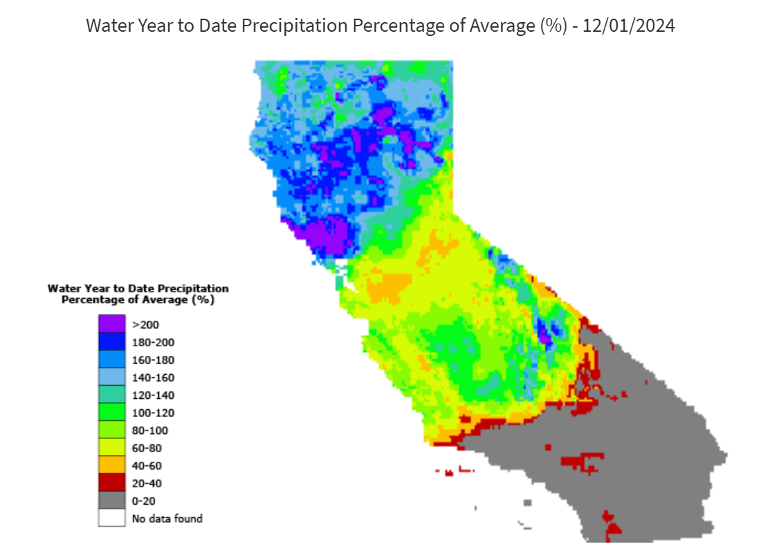
Water year 2025 started off with a dry October, but kicked into full gear during the last third of November when a potent atmospheric river brought significant precipitation to much of California. Many parts of Northern California are 150-200% of normal for this time of year (see graphic below). However, the Central/Southern Sierra was not hit as hard. Precipitation totals range from roughly 50% to 100% of normal I-80 southward. The San Joaquin 5-station index is at 73% for this time of year, and statewide precipitation is 128% of normal.
*source CA Department of Water Resources California Water Watch website
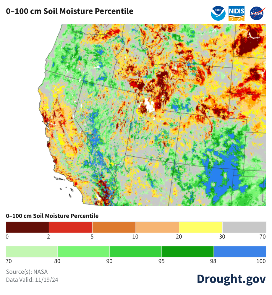
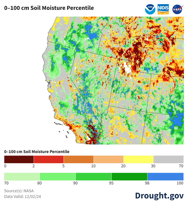
The soil moisture was below normal for much of the state prior to the November storms. Below is a graphical comparison of soil moisture from the National Integrated Drought Information System (NIDIS). On the left is the soil moisture as of Nov 19th, and the right is from Dec 2nd. As you can see, soil moisture improvements are most noticeable throughout Northern CA and the Central Valley.
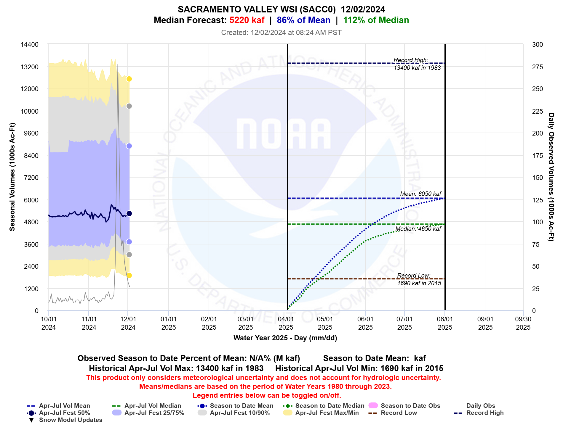
For the first part of November, the Central Valley April-July runoff forecasts were generally tracking 70-75% of normal due to the dry start of the water year. By November 24th, it had increased to 87%, but has since fallen due to the dry outlook. As of Dec 2nd, the Central Valley index April-July runoff forecast has dropped to 82%. A similar trend can be observed in the Sacramento Valley index forecast (see below). The Sacramento Valley Index forecast was 90% on Nov 23rd, but has dropped to 86% as of Dec 2nd.
*source CNRFC
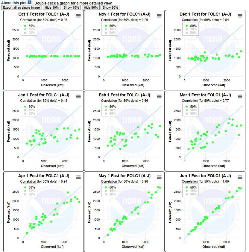
It is important to keep in mind that we are still early in the water year, and a lot can change. All you have to do is look at some of the water supply forecast verification statistics that the CNRFC produced this summer. Below is a scatter plot matrix of April-July runoff forecasts vs observed for Folsom Reservoir. As you can see, the correlations are still very weak for the beginning of December.
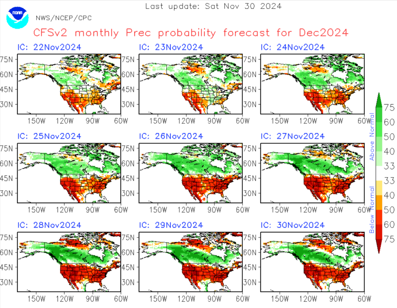
Looking into the future, the month of December is looking pretty dry. The Climate Forecast System Version 2 (CFSv2) has been pointing to a dry December for the majority of the United States.
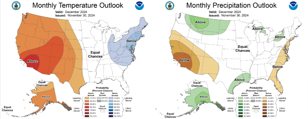
On November 30th, the Climate Prediction Center published their December outlook, and has also indicated below normal for CA-NV with the strongest chances in Southern CA.
*source Climate Prediction Center
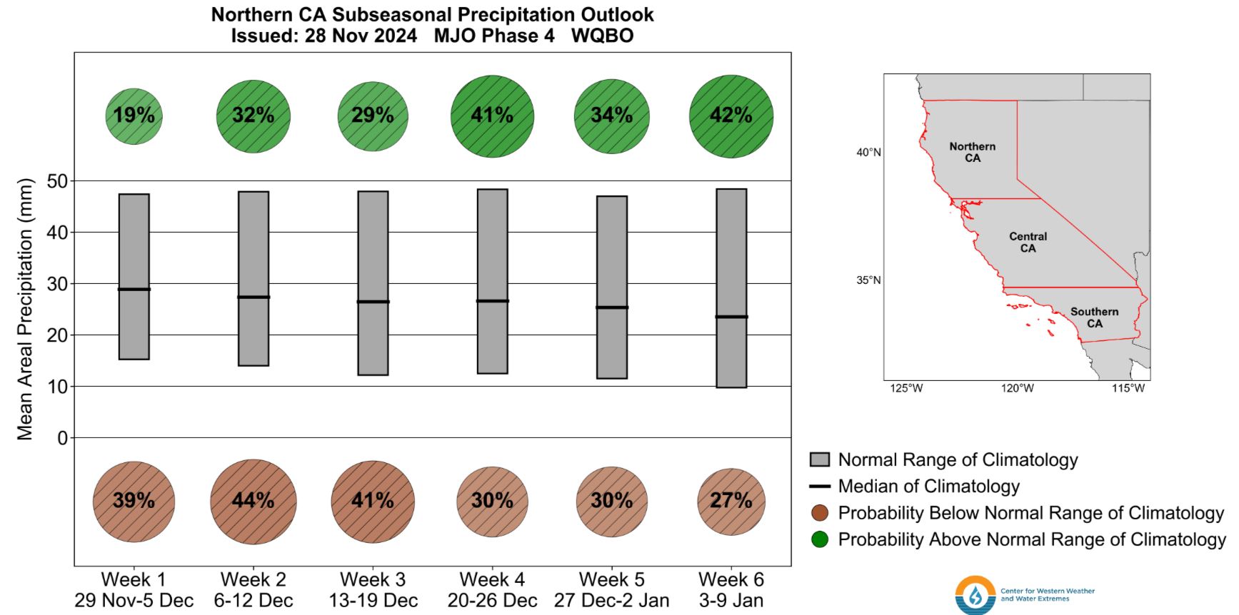
There is a bit of hope that we will see wetter conditions return during the last week of December. The CW3E subseasonal forecast product that takes into account a number of climate indicators including the Madden-Julian Oscillation (MJO) and the Quasi-biennial Oscillation (QBO) is indicating a slightly elevated chance of above normal precipitation for Northern CA for the week of December 20-26. For more information on this product, please visit the CW3E Subseasonal and Seasonal Forecast page.