
| ||||||||||||||||||
| SOUTH FORK AMERICAN RIVER - CHILI BAR RESERVOIR (CBAC1) | ||||||||||||||||||
| Latitude: 38.77º N | Longitude: 120.82º W | Elevation: 931 Feet | ||||||||||||||||
| Location: El Dorado County in CA | ||||||||||||||||||
| River Group: Lower Sacramento | ||||||||||||||||||
| Issuance Time: | Jul 07 2025 at 7:19 AM PDT |
| Please Note: | Ensemble forecasts produced by CNRFC only consider meteorological uncertainty and do not account for hydrologic uncertainty. This section of the South Fork of the American River is highly regulated. Future releases from upstream reservoirs are often unknown. Users seeking recreational flow schedules should consult other sources. |
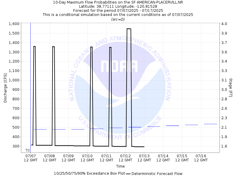
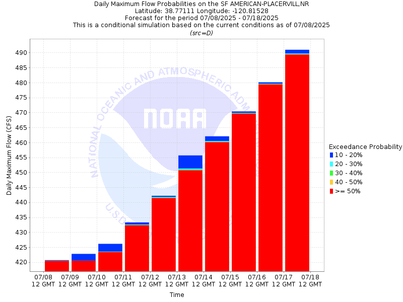
| 10-Day Probability Plot |
| Location Photographs | ||
| ESRI™ Locator Map |
| Official 7 Day National Weather Service Forecast (CAZ067) |
| Tonight: Clear. Lows 55 to 65. Prevailing west winds up to 10 mph in the evening becoming light. Tuesday: Sunny. Highs 82 to 92. Prevailing southwest winds up to 10 mph. Tuesday Night: Clear. Lows 55 to 65. Prevailing west winds up to 10 mph in the evening becoming light. Wednesday: Sunny. Highs 83 to 93. Light winds becoming west up to 10 mph in the afternoon. Wednesday Night: Clear. Lows 60 to 68. Prevailing west winds up to 10 mph in the evening becoming light. Thursday: Sunny, warmer. Highs 90 to 100. Thursday Night: Clear. Lows 64 to 72. Friday through Monday: Clear. Highs 90 to 101. Lows 62 to 72. |