
| ||||||||||||||||||
| SACRAMENTO RIVER - COLUSA BRIDGE (CLUC1) | ||||||||||||||||||
| Latitude: 39.21º N | Longitude: 122.00º W | Elevation: 70 Feet | ||||||||||||||||
| Location: Colusa County in CA | ||||||||||||||||||
| River Group: Upper Sacramento | ||||||||||||||||||
| Issuance Time: | Jun 30 2025 at 9:02 AM PDT |
| Please Note: | Ensemble forecasts produced by CNRFC only consider meteorological uncertainty and do not account for hydrologic uncertainty. |
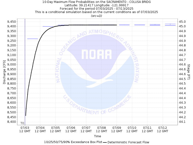
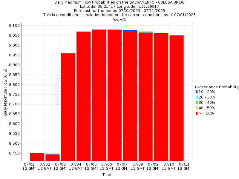
| 10-Day Probability Plot |
| Location Photographs | ||
| ESRI™ Locator Map |
| Official 7 Day National Weather Service Forecast (CAZ016) |
| Today: Sunny. Highs around 98. Southeast winds up to 10 mph. Tonight: Clear. Lows 62 to 70. Southwest winds up to 10 mph in the evening becoming light. Wednesday: Sunny. Highs around 98. Southeast winds up to 10 mph. Wednesday Night: Clear. Lows 62 to 70. Southeast winds up to 10 mph. Thursday: Mostly sunny. Highs around 93. Southeast winds up to 10 mph. Thursday Night: Mostly clear. Lows around 61. Independence Day: Sunny. Highs around 89. Friday Night through Monday: Clear. Lows 56 to 64. Highs around 91. |
| Flood Impacts | |
| 73.0 Feet | Stages above 73.0 feet result in major flooding of the area outside the levees. Top of levee. |
| 67.2 Feet | Water moves into parking lot and patio of RV Park located 0.7 miles downstream of gauge on left bank of river. |
| 65.0 Feet | Water impacts the parking lot of RV Park 4 miles downstream of gauge on left bank of river. RV Park is located inside the levee. |
| 63.0 Feet | Monitor Stage. The Colusa-Sacramento River State Recreation Area begins to experience high water impacts. |