
| ||||||||||||||||||
| YUBA RIVER - MARYSVILLE (MRYC1) | ||||||||||||||||||
| Latitude: 39.18º N | Longitude: 121.52º W | Elevation: 88 Feet | ||||||||||||||||
| Location: Yuba County in CA | ||||||||||||||||||
| River Group: Lower Sacramento | ||||||||||||||||||
| Issuance Time: | Jul 06 2025 at 7:51 AM PDT |
| Please Note: | Ensemble forecasts produced by CNRFC only consider meteorological uncertainty and do not account for hydrologic uncertainty. |
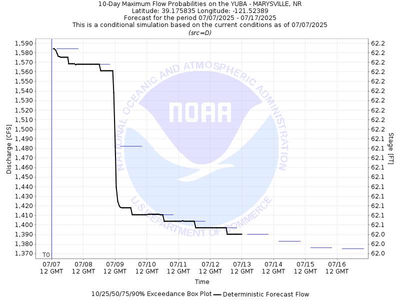
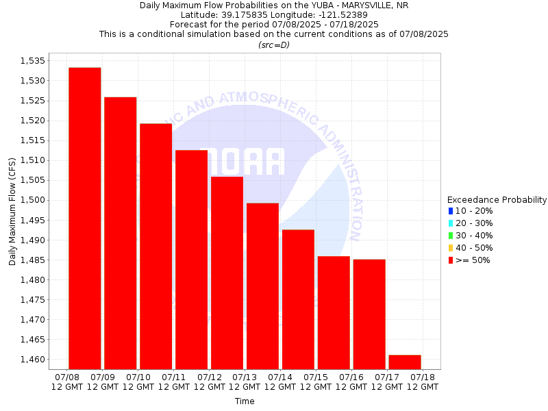
| 10-Day Probability Plot |
| Location Photographs | ||
| ESRI™ Locator Map |
| Official 7 Day National Weather Service Forecast (CAZ016) |
| Today: Sunny. Highs around 94. Light winds becoming south up to 10 mph in the afternoon. Tonight: Clear. Lows 58 to 66. Southeast winds up to 10 mph. Monday: Sunny. Highs around 94. Southeast winds up to 10 mph. Gusts up to 20 mph in the afternoon. Monday Night: Clear. Lows 57 to 63. South winds up to 15 mph. Tuesday: Sunny. Highs around 90. Southeast winds up to 10 mph with gusts to around 20 mph. Tuesday Night: Clear. Lows 57 to 63. Wednesday: Sunny. Highs around 93. Wednesday Night through Saturday: Clear. Lows 63 to 73. Highs 93 to 101. |
| Flood Impacts | |
| 93.0 Feet | Top of levee. Stages above this level result in flooding outside the levee. (datum = used) |
| 87.0 Feet | Flood stage. |
| 80.0 Feet | Simpson Lane becomes impassible. Dantoni Road floods. More orchards flood. |
| 79.0 Feet | Simpson Lane floods. Access into and out of Marysville via Simpson Lane bridge is cut off. Orchards within the levee system are flooded. |
| 74.0 Feet | Monitor stage. |