
| ||||||||||||||||||
| CACHE CREEK - RUMSEY (RMSC1) | ||||||||||||||||||
| Latitude: 38.89º N | Longitude: 122.24º W | Elevation: 400 Feet | ||||||||||||||||
| Location: Yolo County in CA | ||||||||||||||||||
| River Group: Lower Sacramento | ||||||||||||||||||
| Issuance Time: | Jul 01 2025 at 7:45 AM PDT |
| Please Note: | Ensemble forecasts produced by CNRFC only consider meteorological uncertainty and do not account for hydrologic uncertainty. |
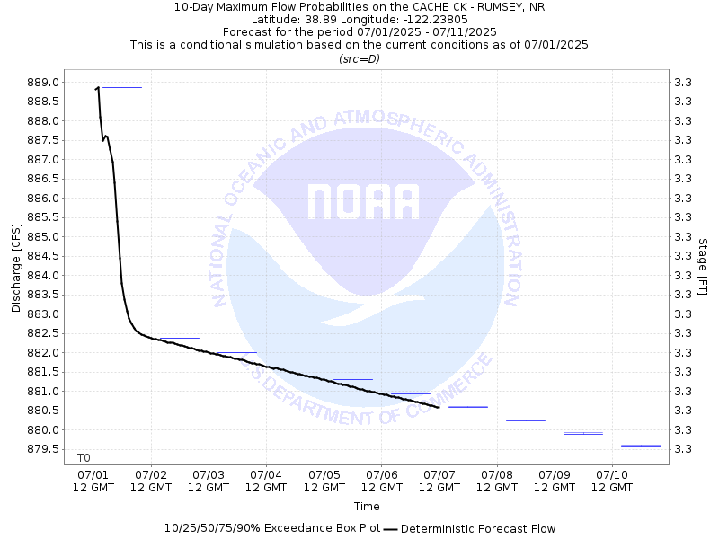
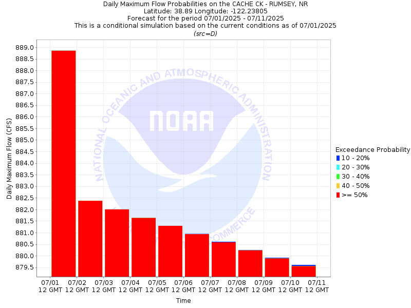
| 10-Day Probability Plot |
| Location Photographs | ||
| ESRI™ Locator Map |
| Official 7 Day National Weather Service Forecast (CAZ017) |
| Today: Sunny. Highs 91 to 101. South winds up to 10 mph. Gusts up to 25 mph in the afternoon. Tonight: Clear. Lows 56 to 66. South winds up to 15 mph with gusts to around 25 mph. Wednesday: Sunny. Highs 90 to 100. South winds up to 10 mph. Wednesday Night: Clear. Lows 56 to 66. South winds 10 to 15 mph with gusts to around 25 mph. Thursday: Mostly sunny. Highs 88 to 96. South winds up to 10 mph with gusts to around 20 mph. Thursday Night: Clear. Lows 54 to 62. Independence Day: Sunny. Highs 83 to 91. Friday Night through Monday: Clear. Lows 52 to 61. Highs 84 to 94. |
| Flood Impacts | |
| 17.0 Feet | Highway 16 is closed. The town of Rumsey is cut off due to high water. |
| 17.0 Feet | Highway 16 is closed. The town of Rumsey is cut off due to high water. |
| 14.0 Feet | Cache Creek leaves its banks flooding low lying orchards and farm land around the creek. |