
| ||||||||||||||||||
| SACRAMENTO RIVER - SACRAMENTO AT I STREET (SACC1) | ||||||||||||||||||
| Latitude: 38.59º N | Longitude: 121.50º W | Elevation: 27 Feet | ||||||||||||||||
| Location: Sacramento County in CA | ||||||||||||||||||
| River Group: Lower Sacramento | ||||||||||||||||||
| Issuance Time: | Jul 07 2025 at 8:10 AM PDT |
| Please Note: | Ensemble forecasts produced by CNRFC only consider meteorological uncertainty and do not account for hydrologic uncertainty. |
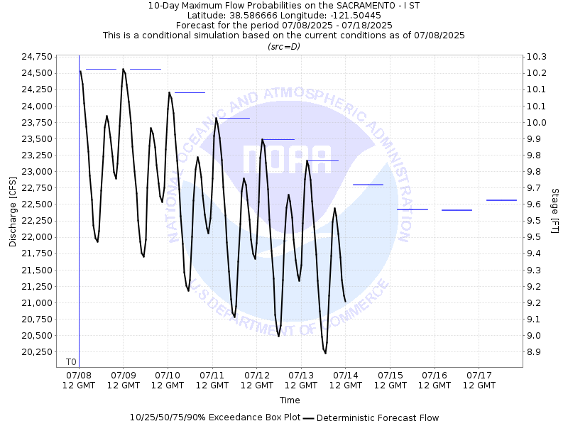
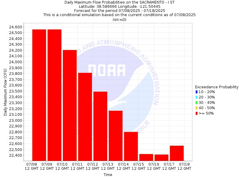
| 10-Day Probability Plot |
| Location Photographs | ||
| ESRI™ Locator Map |
| Official 7 Day National Weather Service Forecast (CAZ017) |
| Today: Sunny. Highs 83 to 93. Southwest winds up to 10 mph with gusts to around 20 mph. Tonight: Clear. Lows 53 to 60. Southwest winds up to 10 mph with gusts to around 20 mph. Wednesday: Sunny. Highs 90 to 96. Light winds becoming west up to 10 mph in the afternoon. Wednesday Night: Clear. Lows 58 to 68. West winds up to 10 mph in the evening becoming light. Thursday: Sunny. Highs 97 to 103. Northwest winds up to 10 mph. Thursday Night: Clear. Lows 60 to 70. Friday: Sunny. Highs 96 to 104. Friday Night through Monday: Clear. Lows 57 to 67. Highs 93 to 103. |
| Flood Impacts | |
| 36.4 Feet | Stages above 36.4 feet result in major flooding outside levees. Top of levee. |
| 21.4 Feet | Discovery Park is closed to the public. |