
| ||||||||||||||||||
| SACRAMENTO RIVER - VERONA (VONC1) | ||||||||||||||||||
| Latitude: 38.78º N | Longitude: 121.60º W | Elevation: 43 Feet | ||||||||||||||||
| Location: Sutter County in CA | ||||||||||||||||||
| River Group: Lower Sacramento | ||||||||||||||||||
| Issuance Time: | Jul 05 2025 at 8:57 AM PDT |
| Please Note: | Ensemble forecasts produced by CNRFC only consider meteorological uncertainty and do not account for hydrologic uncertainty. |
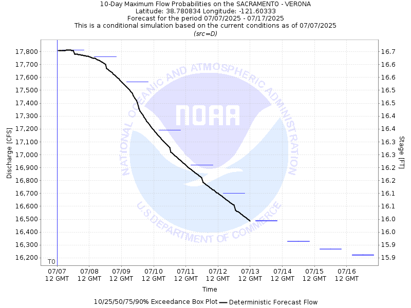
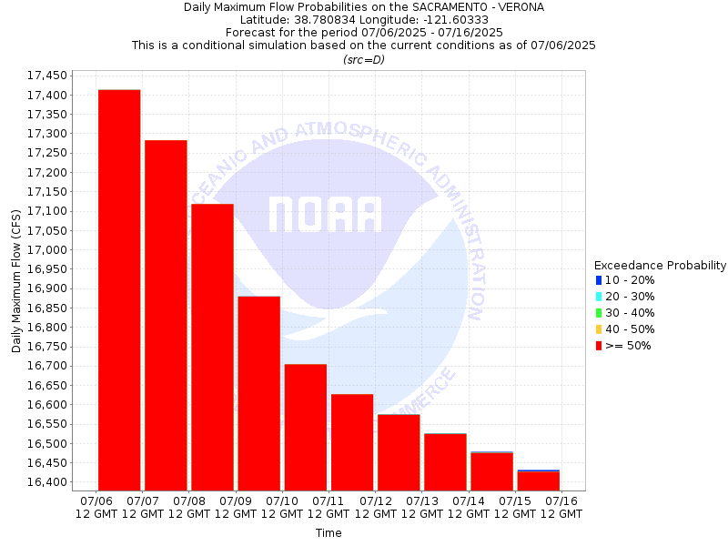
| 10-Day Probability Plot |
| Location Photographs | ||
| ESRI™ Locator Map |
| Official 7 Day National Weather Service Forecast (CAZ017) |
| Today: Sunny. Highs 88 to 96. Southwest winds up to 10 mph. Tonight: Clear. Lows 53 to 63. South winds up to 10 mph with gusts to around 20 mph. Monday: Sunny. Highs 86 to 96. South winds up to 10 mph with gusts to around 20 mph. Monday Night: Clear. Lows 53 to 61. Southwest winds 10 to 15 mph with gusts to around 25 mph. Tuesday: Sunny. Highs 83 to 93. South winds up to 10 mph with gusts to around 20 mph. Tuesday Night: Clear. Lows 53 to 61. Wednesday: Sunny. Highs 90 to 96. Wednesday Night through Saturday: Clear. Lows 60 to 70. Highs 92 to 102. |
| Flood Impacts | |
| 46.0 Feet | Stages above 46.0 feet result in flooding outside the levees. Top of levee. |