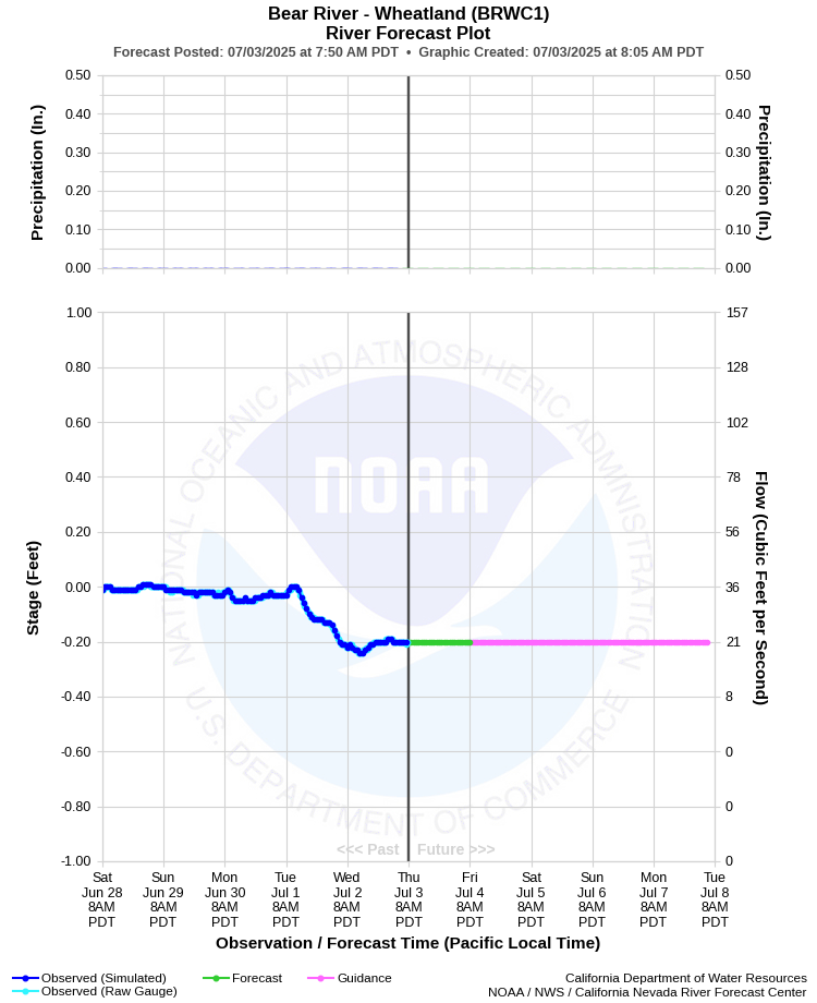
| BEAR RIVER - WHEATLAND (BRWC1) | ||
| Latitude: 39.00º N | Longitude: 121.41º W | Elevation: 72 Feet |
| Location: Placer County in CA | ||
| River Group: Lower Sacramento | ||
| Forecast Issued: | Jul 03 2025 at 8:04 AM PDT | Next Issuance: | Jul 04 2025 at 9:00 AM PDT |
| Action/ Monitor: 16.0 Ft | Minor Flood: 24.0 Ft | Moderate Flood: 32.1 Ft | Major Flood: 33.1 Ft |
Prev. Point | Next Point | Tabular |
Back to Points | Back to Home |
 |
Historical Stage/Flow Data |
|||
|
Water Year
|
Peak Discharge (cfs)
|
Stage (feet)
|
Date
|
| Most Recent 5 Years | |||
2024 |
5,760 |
10.04 |
Mar 2, 2024 |
2023 |
10,600 |
14.16 |
Mar 15, 2023 |
2022 |
4,140 |
8.45 |
Dec 27, 2021 |
2021 |
56 |
0.31 |
Aug 7, 2021 |
2020 |
3,340 |
7.66 |
Apr 6, 2020 |
| Historical High Stage/Flow Events (Period of Record - Oct 1928 to Present) - Ranked by Flow | |||
1986 |
48,000 |
21.60 |
Feb 17, 1986 |
2006 |
36,400 |
24.28 |
Dec 31, 2005 |
1997 |
34,900 |
23.72 |
Jan 02, 1997 |
| 1956 | 33,100 | 21.30 | Dec 22, 1955 |
2017 |
32,300 |
23.71 |
Jan 11, 2017 |
| 1943 | 31,300 | 16.95 | Jan 1, 1943 |
| Location Photographs | ||
| ESRI™ Locator Map |
| Flood Impacts | |
| 33.1 Feet | Top of right bank levee. Stages above this level result in flooding outside the levee. |
| 13.6 Feet | Orchards within the levee downstream near Pleasant Grove Road begin to flood. |