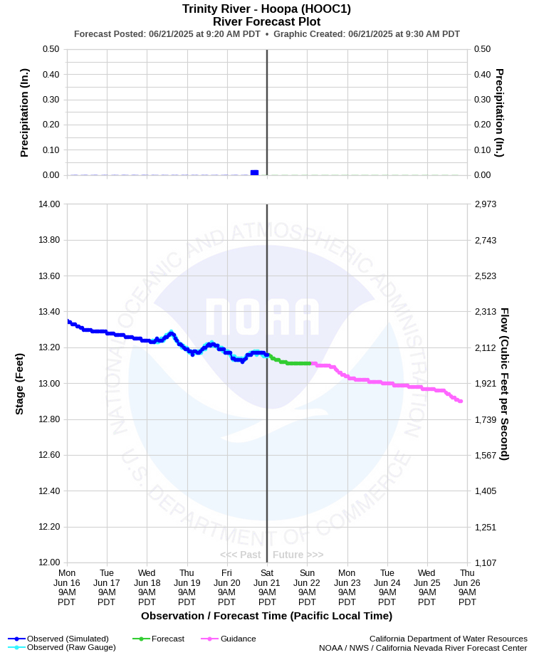
| TRINITY RIVER - HOOPA (HOOC1) | ||
| Latitude: 41.05º N | Longitude: 123.68º W | Elevation: 333 Feet |
| Location: Humboldt County in CA | ||
| River Group: North Coast | ||
| Forecast Issued: | Jun 20 2025 at 11:22 AM PDT | Next Issuance: | Jun 21 2025 at 9:00 AM PDT |
| Action/ Monitor: 44.0 Ft | Minor Flood: 48.0 Ft | Moderate Flood: 52.0 Ft | Major Flood: 56.0 Ft |
Prev. Point | Next Point | Tabular |
Back to Points | Back to Home | Ensemble Fcst |
 |
Historical Stage/Flow Data |
|||
|
Water Year
|
Peak Discharge (cfs)
|
Stage (feet)
|
Date
|
| Most Recent 5 Years | |||
2024* |
46,500 |
28.44 |
Jan 14, 2024 |
2023* |
66,500 |
32.28 |
Mar 15, 2023 |
2022* |
16,600 |
20.91 |
Jan 8, 2022 |
2021* |
13,300 |
19.67 |
Feb 16, 2021 |
2020* |
25,100 |
23.65 |
Jan 26, 2020 |
| Historical High Stage/Flow Events (Period of Record - Oct 1931 to Present)** - Ranked by Flow | |||
1965* |
231,000 |
57.00 |
Dec 22, 1964 |
1956 |
190,000 |
36.90 |
Dec 22, 1955 |
1974* |
145,000 |
45.98 |
Jan 16, 1974 |
1983* |
122,000 |
43.16 |
Jan 27, 1983 |
1997* |
122,000 |
42.97 |
Jan 01, 1997 |
1986* |
116,000 |
42.43 |
Feb 18, 1986 |
| * Discharge affected by regulation or diversion | |||
| ** Most recent continuous record back to Oct 1931 with segmented periods back to Oct 1911 | |||
| Location Photographs | ||
| ESRI™ Locator Map |
| Flood Impacts | |
| 57.0 Feet | Severe flooding of roads, bridges and structures in and around low areas of the river is expected. Many road closures are likely including Highway 96 at several locations between Willow Creek and Weitchpec. Many homes and businesses in valley areas will be innundated. |
| 55.0 Feet | Extensive and severe flooding between Willow Creek and Weitchpec, and flooding of many homes and businesses in the valley areas. Expect closure of Highway 96 between Willow Creek and Weitchpec. |
| 53.0 Feet | Extensive flooding of all low lying areas adjacent to the river, including Highway 96 north and south of Hoopa. Significant damage to structures in these areas is likely. |
| 51.0 Feet | Extensive flooding of all low lying areas adjacent to the river including Highway 96 both north and south of Hoopa is likely. Significant damage to structures in these areas is possible. |
| 48.0 Feet | Considerable flooding of low lying areas adjacent to the river including Highway 96 is likely. Significant damage to structures in these areas is possible. |
| 46.0 Feet | Flooding of many low lying areas near the river is likely. Minor flooding may occur over Highway 96 between Willow Creek and Hoopa. |
| 44.0 Feet | Minor flooding of the lowest lying areas may occur. |