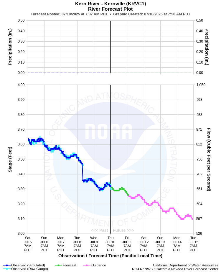
| KERN RIVER - KERNVILLE (KRVC1) | ||
| Latitude: 35.75º N | Longitude: 118.42º W | Elevation: 2637 Feet |
| Location: Kern County in CA | ||
| River Group: San Joaquin | ||
| Forecast Issued: | Jul 09 2025 at 7:48 AM PDT |
| Next Issuance: | Jul 10 2025 at 9:00 AM PDT |
| Action/ Monitor: 12.5 Ft | Minor Flood: 13.5 Ft | Moderate Flood: 17.0 Ft | Major Flood: 20.0 Ft |
Prev. Point | Next Point | Tabular |
Back to Points | Back to Home | Ensemble Fcst |
| Please Note: | Raw observed data may be unreliable due to gauge damage and river bank erosion sustained during the recent 2023 floods. This may increase forecast uncertainty. |
 |
Historical Stage/Flow Data |
|||
|
Water Year
|
Peak Discharge (cfs)
|
Stage (feet)
|
Date
|
| Most Recent 5 Years | |||
2024 |
3,800 |
7.09 |
May 18, 2024 |
| 2023 | 41,400 |
17.77 |
Mar 10, 2023 |
| 2022 | 1,990 | 7.49 | Dec 24, 2021 |
2021 |
787 | 6.17 | May 8, 2021 |
2020 |
2,040 |
7.54 |
May 1, 2020 |
| Historical High Stage/Flow Events (Period of Record - Jan 2010 to Present) - Ranked by Flow | |||
| 2023 | 41,400 |
17.77 |
Mar 10, 2023 |
2017 |
-- |
13.50 |
Feb 7, 2017 |
| 2011 | -- | 13.18 | Dec 19, 2010 |
| Location Photographs | ||
| ESRI™ Locator Map |
| Flood Impacts | |
| 13.5 Feet | Kern River adjacent to Riverside Park begins to escape its banks, flooding the lower park sidewalk. This is Preliminary Flood Stage. |