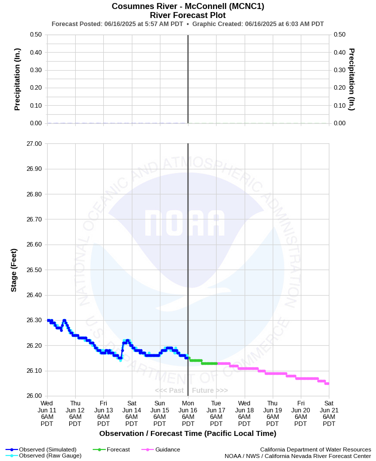
| COSUMNES RIVER - MCCONNELL (MCNC1) | ||
| Latitude: 38.36º N | Longitude: 121.34º W | Elevation: 5 Feet |
| Location: Sacramento County in CA | ||
| River Group: San Joaquin | ||
| Forecast Issued: | Jun 16 2025 at 6:03 AM PDT | Next Issuance: | Jun 17 2025 at 9:00 AM PDT |
| Action/ Monitor: 38.5 Ft | Minor Flood: 44.5 Ft | Moderate Flood: 53.4 Ft | Major Flood: 53.5 Ft |
Prev. Point | Next Point | Tabular |
Back to Points | Back to Home | Ensemble Fcst |
| Please Note: | On June 20, 2023, the datum was changed from USED to NAVD88 (+2.46 feet). As a result the monitor stage was updated to 38.5 ft and flood stage was updated to 44.5 ft. |
 |
Historical Stage/Flow Data |
|||
|
Water Year
|
Peak Discharge (cfs)
|
Stage (feet)
|
Date
|
| Most Recent 5 Years | |||
2024* |
13,400 |
42.98 |
Mar 2, 2024 |
2023* |
73,600*** |
46.64*** |
Jan 1, 2023 |
2022* |
7,790 |
38.99 |
Dec 24, 2021 |
2021* |
3,000 |
32.00 |
Jan 29, 2021 |
2020* |
6,890 |
38.18 |
Apr 6, 2020 |
| Historical High Stage/Flow Events (Period of Record - Jan 1952 to Present) - Ranked by Flow | |||
1997* |
-- |
48.50 |
Jan 02, 1997 |
1986 |
-- |
47.10 |
Feb 18, 1986 |
2023* |
73,600*** |
46.64*** |
Jan 1, 2023 |
2006* |
36,209 |
47.02 |
Jan 01, 2006 |
1998* |
-- |
46.56 |
Feb 04, 1998 |
| * Discharge affected by regulation or diversion | |||
| ** Dataum changed from USED to NAVD88 on 06/20/2023. The difference is +2.46 ft and must be applied to all data before date to convert to NAVD88. | |||
| *** Estimated from simulated data. Gauge data not reliable from Jan 1, 2023 through Jan 10, 2023. | |||
| Location Photographs | ||
| ESRI™ Locator Map |
| Flood Impacts | |
| 46.5 Feet | At approximately 44,000 cfs, water exits the river upstream and downstream of Highway 99. Dillard Road is flooded from Highway 99 to Riley Road. Twin Cities Road is flooded from Hardesty Lane to Christensen Road. |
| 44.5 Feet | Flood stage. |
| 41.5 Feet | The Cosumnes River overflow channel begins to flow. |
| 38.5 Feet | Monitor Stage. |