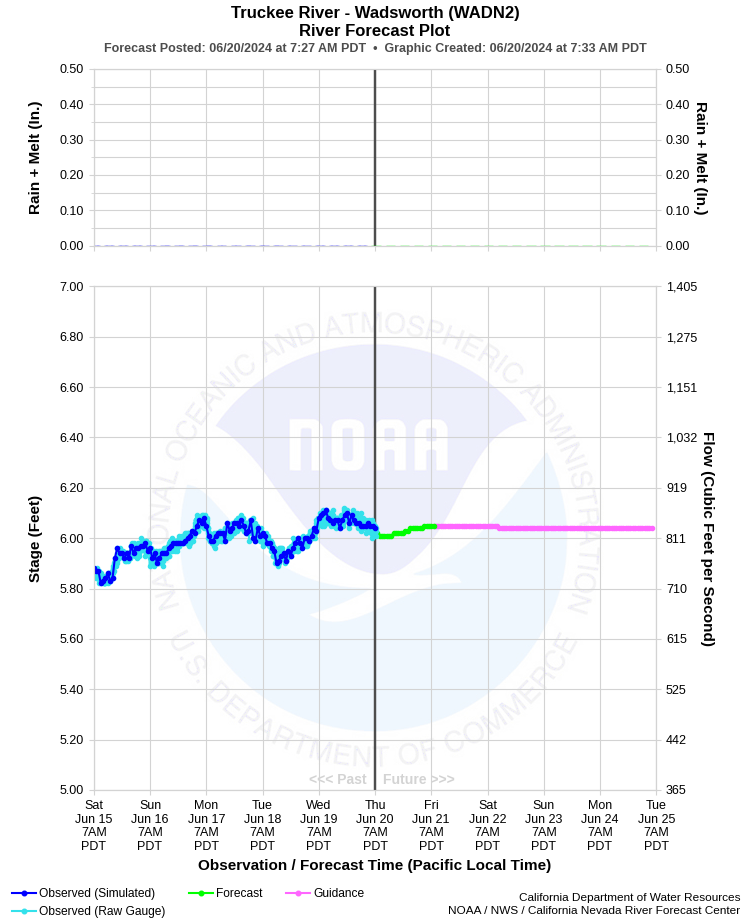
| TRUCKEE RIVER - WADSWORTH (WADN2) | ||
| Latitude: 39.63º N | Longitude: 119.28º W | Elevation: 4070 Feet |
| Location: Washoe County in NV | ||
| River Group: Eastern Sierra | ||
| Forecast Issued: | May 18 2024 at 8:45 AM PDT | Next Issuance: | May 19 2024 at 9:00 AM PDT |
| Monitor Stage: 13.0 Feet | Flood Stage: 15.0 Feet |
Prev. Point | Next Point | Tabular |
Back to Points | Back to Home | Ensemble Fcst |
 |
Historical Stage/Flow Data |
|||
|
Water Year
|
Peak Discharge (cfs)
|
Stage (feet)
|
Date
|
| Most Recent 5 Years | |||
2022* |
5,380 |
11.14 |
Oct 25, 2021 |
2021* |
487 |
5.18 |
Jun 4, 2021 |
2020* |
1,490 |
7.07 |
May 18, 2020 |
2019* |
6,670 |
12.38 |
Feb 14, 2019 |
2018* |
6,020 |
11.73 |
Apr 8, 2018 |
| Historical High Stage/Flow Events (Period of Record - Discontinuous 1965 - Present) - Ranked by Flow | |||
1997* |
19,100 |
19.64 |
Jan 3, 1997 |
1986* |
16,800 |
15.11** |
Feb 19, 1986 |
2006* |
14,800 |
16.89 |
Dec 31, 2005 |
2017* |
14,500 |
16.99 |
Jan 9, 2017 |
| * Discharge affected to unknown degree by regulation or diversion | |||
| ** Prior to September 1986, gage was located 0.5 mile downstream at a different datum. | |||
| Location Photographs | ||
| ESRI™ Locator Map |
| Impacts - E19 Information | |
| 13.0 Feet | Monitor stage. Very high flow, but no flooding between between Derby Dam and Nixon, river is near bank full in some areas. |
| 15.0 Feet | Flood stage. Minor flooding of agricultural lands along the river. |
| 17.0 Feet | Significant flooding of agricultural lands and some rural roads along the river. Water approaching some low lying homes near Wadsworth and Nixon. Access to several homes may be limited or closed. Similar to 1/9/2017 and 12/31/2005 peaks. |
| 19.0 Feet | Major flooding of agricultural lands and rural roads between Derby Dam and Nixon, including some structures in Wadsworth and Nixon. These areas include but not limited to Consetoga Ave, Quail Ave, and West Truckee River Ranch Road. |
| 20.0 Feet | Near record flooding. Extensive flooding of agricultural areas, roads, homes and infrastructure between Derby Dam and Nixon. Numerous homes impacted near Wadsworth. Slightly in excess of January 1997 peak. |