
|
CNRFC Daily Briefing
Last issued: Tue May 07, 2024 at 09:27 AM PST (updated daily by 10 AM Pacific Time).
Click image for full-resolution version. 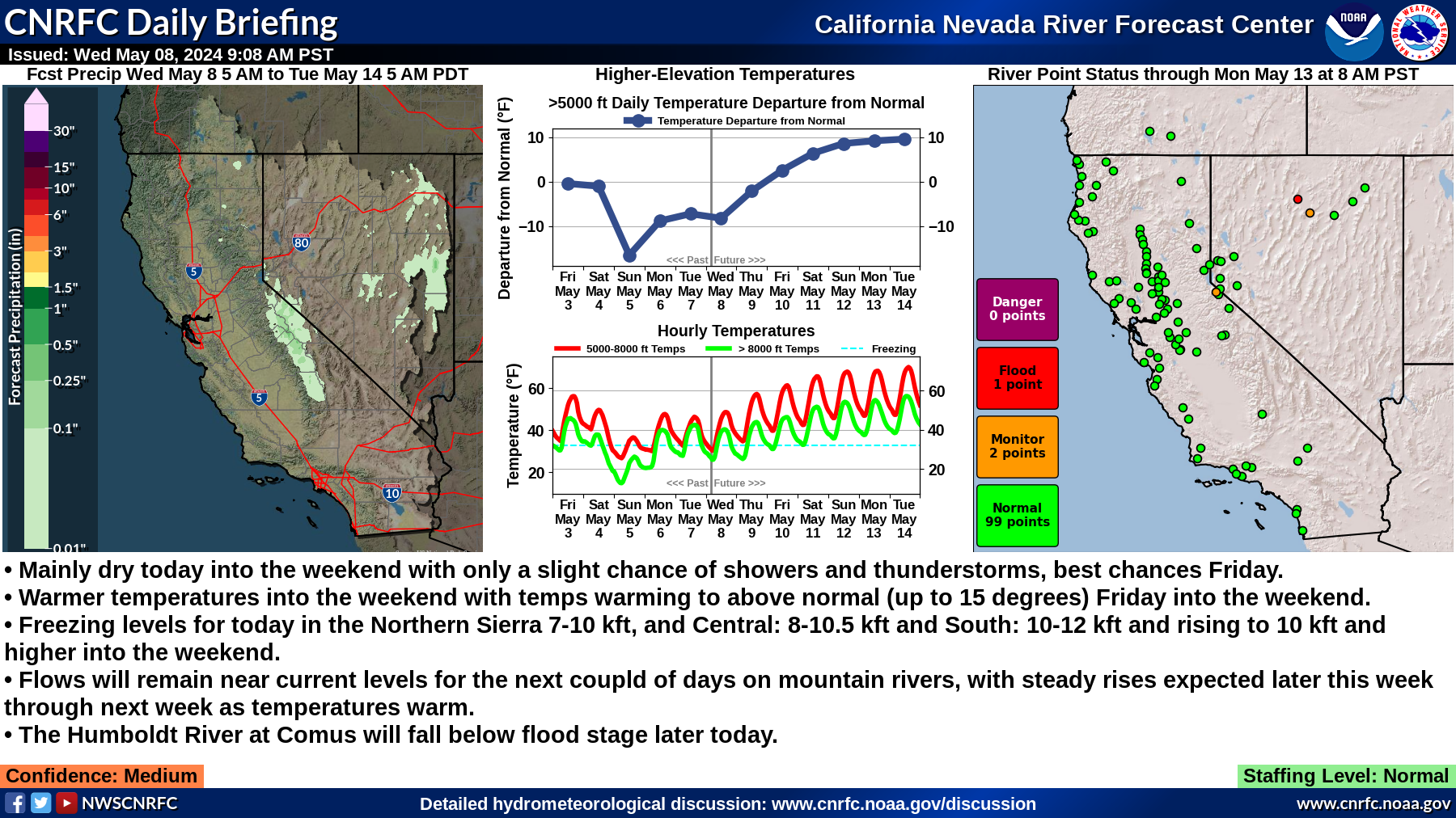
Summary:
Staffing Level: Normal Detailed Hydrometeorological Discussion: www.cnrfc.noaa.gov/discussion |
| River Guidance Points Forecast Above Specified Stage Definitions (Select NWS ID for Specified Graphical RVF) | ||||||||||
| NWS ID | River / Creek | Gage / Station | Monitor Stage | Flood Stage | Danger Stage | Latest Observed Stage / Flow | Latest Observed Date / Time | Max Forecast Stage / Flow | Forecast Status | |
| WOOC1 | WEST FORK CARSON | WOODFORDS | 12.5 | 13.5 | 11.71 / 213 | 05/08 07:50 AM PDT | 12.64 / 474 | Above Monitor | ||
| HBMN2 | HUMBOLDT | BATTLE MOUNTAIN | 8.5 | 9.5 | 8.61 / 1,589 | 05/08 07:15 AM PDT | 8.59 / 1,579 | Above Monitor | ||
| CMSN2 | HUMBOLDT | COMUS | 8.5 | 9.5 | 9.61 / 1,775 | 05/08 07:15 AM PDT | 9.55 / 1,739 | Above Flood | ||
** NOTE ** Stage is presented in "Feet" while Flow (Storage at CLKC1) is presented in "cfs" ("Acre-Feet"). | ||||||||||