CNRFC Mobile Logo


CNRFC Daily Briefing
Last issued: Tue May 07, 2024 at 09:27 AM PST (updated daily by 10 AM Pacific Time).
Click image for full-resolution version.
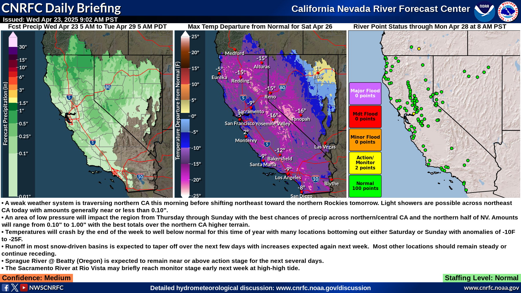


Summary:
  • Scattered showers and isolated thunderstorms over NE NV today...then mainly dry Wednesday into the weekend with only a slight chance of showers and thunderstorms.
  • Warmer temperatures into the weekend with temps warming to above normal (up to 15 degrees) Friday into the weekend.
  • Freezing levels for today and Wednesday in the Northern Sierra 7-9 kft, and Central: 8-10.5 kft and South: 10-12 kft and rising to 10 kft and higher into the weekend.
  • Flows will remain mostly steady the next several days on mountain rivers, with moderate rises expected later this week through next week as temperatures warm.
  • The lower Humboldt River is expected to remain above flood stage for another 24 to 48 hours.
Confidence: Medium

Staffing Level: Normal

Detailed Hydrometeorological Discussion: www.cnrfc.noaa.gov/discussion

River Guidance Forecast Critical Stage Exceedance
ID River / Creek Gage / Station Forecast Status

WOOC1

WEST FORK CARSON WOODFORDS Above Monitor

HBMN2

HUMBOLDT BATTLE MOUNTAIN Above Monitor

CMSN2

HUMBOLDT COMUS Above Flood

Select ID from list above to view graphical river forecast.