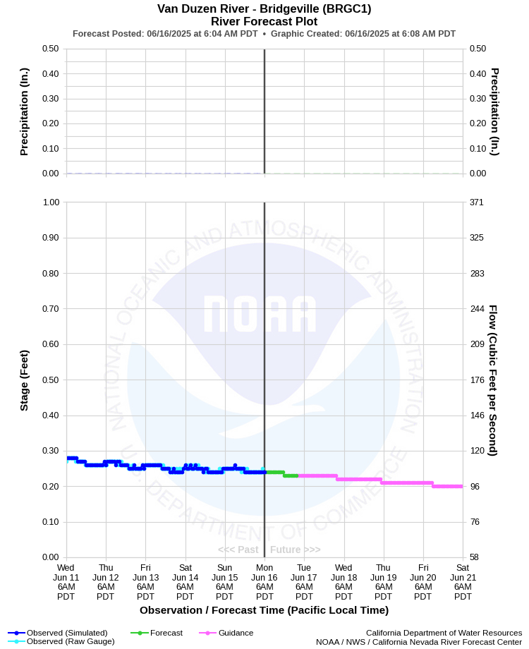
| VAN DUZEN RIVER - BRIDGEVILLE (BRGC1) | ||
| Latitude: 40.48º N | Longitude: 123.89º W | Elevation: 358 Feet |
| Location: Humboldt County in CA | ||
| River Group: North Coast | ||
| Forecast Issued: | Jun 16 2025 at 6:07 AM PDT | Next Issuance: | Jun 17 2025 at 9:00 AM PDT |
| Action/ Monitor: 13.0 Ft | Minor Flood: 17.0 Ft | Moderate Flood: 20.0 Ft | Major Flood: 23.0 Ft |
Prev. Point | Next Point | Tabular |
Back to Points | Back to Home | Ensemble Fcst |
 |
Historical Stage/Flow Data |
|||
|
Water Year
|
Peak Discharge (cfs)
|
Stage (feet)
|
Date
|
| Most Recent 5 Years | |||
2024 |
19,300 |
12.20 |
Jan 13, 2024 |
2023 |
23,200 |
13.77 |
Mar 14, 2023 |
2022 |
8,880 |
7.53 |
Jan 4, 2022 |
2021 |
8,260 |
7.21 |
Feb 2, 2021 |
2020 |
9,560 |
7.97 |
Jan 26, 2020 |
| Historical High Stage/Flow Events (Period of Record - Oct 1950 to Present) - Ranked by Flow | |||
1965 |
48,700 |
24.00 |
Dec 22, 1964 |
1995 |
43,700 |
19.72 |
Jan 09, 1995
|
1997 |
37,100 |
18.73 |
Dec 31, 1996 |
| 1986 |
36,900 |
18.17 |
Feb 17, 1986
|
| Location Photographs | ||
| ESRI™ Locator Map |
| Flood Impacts | |
| 25.0 Feet | Extensive, severe, record flooding from Bridgeville downstream to the mouth including portions of US Highway 101. All persons near the river should be prepared to take appropriate actions to protect life and property. |
| 24.0 Feet | Extensive, severe, near record flooding from Bridgeville downstream to the mouth including portions of US Highway 101. All persons near the river should be prepared to take appropriate actions to protect life and property. |
| 23.0 Feet | Extensive, severe flooding with closure of Highway 36 east of Carlotta to near the Grizzly Creek Bridge. River Bar Road in the Starvation Flats area will be impassable. |
| 21.0 Feet | Flooding of Highway 36 east of Carlotta and near the Grizzly Creek Bridge with water over the road in numerous locations. Portions of River Bar Road in Starvation Flats will likely be impassable. Water level in Grizzly Creek State Park will approach Highway 36. |
| 20.0 Feet | Flooding of Highway 36, especially east of Carlotta and near Grizzly Creek State Park. Portions of River Bar Road in the Starvation Flats area are likely to be impassable. In the State Park water may reach near the office. |
| 19.0 Feet | Flooding of Highway 36 near Grizzly Creek State Park and along River Bar Road in the Starvation flats area. Water level at the State Park reaches the parking lot. |
| 18.0 Feet | Minor flooding of Highway 36 near Grizzly Creek State Park and in lower portions of the State Park itself. Moderate flooding of River Bar Road in the Starvation Flats area. |
| 17.0 Feet | Flooding begins in lower portions of Grizzly Creek State Park and along River Bar Road. |