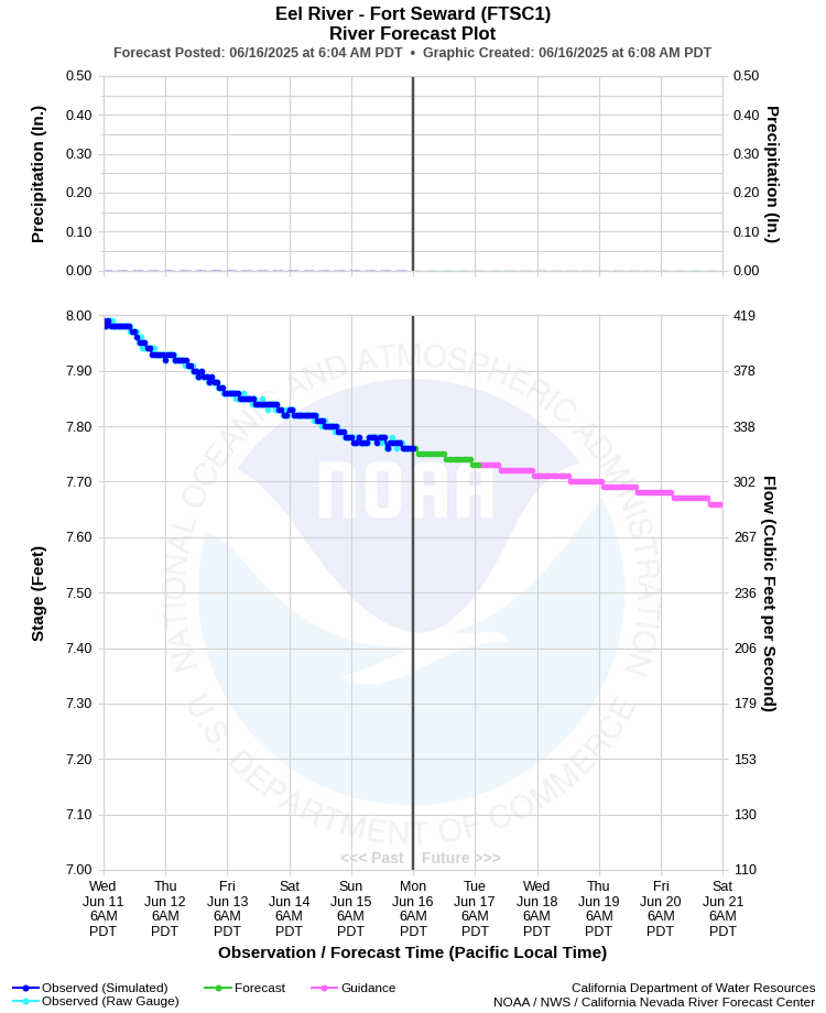
| EEL RIVER - FORT SEWARD (FTSC1) | ||
| Latitude: 40.22º N | Longitude: 123.63º W | Elevation: 217 Feet |
| Location: Humboldt County in CA | ||
| River Group: North Coast | ||
| Forecast Issued: | Jun 16 2025 at 6:07 AM PDT | Next Issuance: | Jun 17 2025 at 9:00 AM PDT |
| Action/ Monitor: 55.0 Ft | Minor Flood: 70.0 Ft | Moderate Flood: 80.0 Ft | Major Flood: 90.0 Ft |
Prev. Point | Next Point | Tabular |
Back to Points | Back to Home | Ensemble Fcst |
 |
Historical Stage/Flow Data |
|||
|
Water Year
|
Peak Discharge (cfs)
|
Stage (feet)
|
Date
|
| Most Recent 5 Years | |||
2024* |
69,200 |
29.71 |
Jan 14, 2024 |
2023* |
119,000 |
38.84 |
Dec 31, 2022 |
2022* |
50,100 |
26.93 |
Oct 24, 2021 |
2021* |
17,000 |
18.07 |
Feb 2, 2021 |
2020* |
32,000 |
22.62 |
Jan 26, 2020 |
| Historical High Stage/Flow Events (Period of Record - Sept 1955 to Present) - Ranked by Flow | |||
1965* |
561,000 |
82.60 |
Dec 22, 1964 |
1956* |
376,000 |
72.50 |
Dec 22, 1955
|
1986* |
306,000 |
59.27 |
Feb 17, 1986 |
1995* |
287,000 |
57.34 |
Jan 09, 1995 |
1974* |
281,000 |
56.75 |
Jan 16, 1974 |
1997* |
240,000 |
52.86 |
Jan 01, 1997 |
| * Discharge affected to unknown degree by regulation or diversion | |||
| Location Photographs | ||
| ESRI™ Locator Map |
| Flood Impacts | |
| 83.0 Feet | Considerable flooding of low lying areas north of the railroad tracks in Alderpoint and Fort Seward, and around the Dobbyns creek confluence. This forecast exceeds record river levels. |
| 80.0 Feet | Flooding is probable in low lying areas north of the railroad tracks in alderpoint and fort seward, and around the dobbyns creek confluence. |
| 78.0 Feet | Minor flooding is possible in low lying areas north of the railroad tracks in Alderpoint and Fort Seward, and around the Dobbyns Creek confluence. |