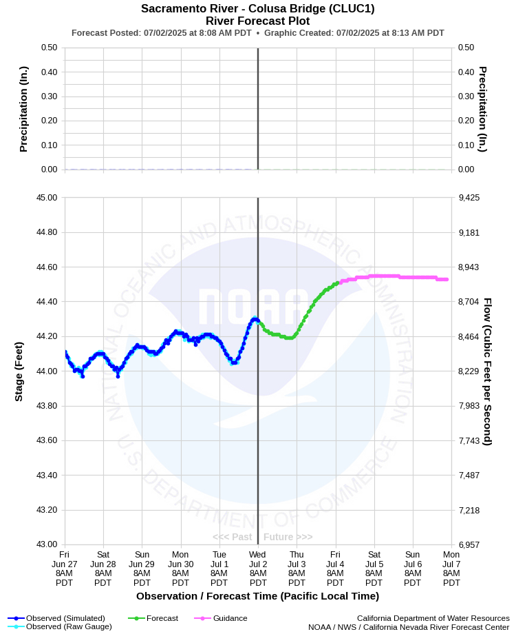
| SACRAMENTO RIVER - COLUSA BRIDGE (CLUC1) | ||
| Latitude: 39.21º N | Longitude: 122.00º W | Elevation: 70 Feet |
| Location: Colusa County in CA | ||
| River Group: Upper Sacramento | ||
| Forecast Issued: | Jul 02 2025 at 8:12 AM PDT | Next Issuance: | Jul 03 2025 at 9:00 AM PDT |
| Action/ Monitor: 63.0 Ft | Minor Flood: 70.0 Ft | Moderate Flood: 72.0 Ft | Major Flood: 73.0 Ft |
Prev. Point | Next Point | Tabular |
Back to Points | Back to Home | Ensemble Fcst |
 |
Historical Stage/Flow Data |
|||
|
Water Year
|
Peak Discharge (cfs)
|
Stage (feet)
|
Date
|
| Most Recent 5 Years | |||
2024* |
48,800 |
67.44 |
Feb 21, 2024 |
2023* |
48,000 |
67.26 |
Jan 16, 2023 |
2022* |
29,900 |
59.51 |
Oct 26, 2021 |
2021* |
11,500 |
46.82 |
Jan 30, 2021 |
2020* |
20,200 |
53.55 |
Jan 27, 2020 |
| Historical High Stage/Flow Events (Period of Record - Oct 1940 to Present) - Ranked by Flow | |||
1983* |
51,800 |
68.50 |
Mar 04, 1983 |
2019* |
51,100 |
68.33 |
Mar 1, 2019 |
2017* |
50,900 |
68.25 |
Feb 20, 2017 |
1998* |
50,300 |
68.02 |
Feb 05, 1998 |
| * Discharge affected by regulation or diversion | |||
| Location Photographs | ||
| ESRI™ Locator Map |
| Flood Impacts | |
| 73.0 Feet | Stages above 73.0 feet result in major flooding of the area outside the levees. Top of levee. |
| 67.2 Feet | Water moves into parking lot and patio of RV Park located 0.7 miles downstream of gauge on left bank of river. |
| 65.0 Feet | Water impacts the parking lot of RV Park 4 miles downstream of gauge on left bank of river. RV Park is located inside the levee. |
| 63.0 Feet | Monitor Stage. The Colusa-Sacramento River State Recreation Area begins to experience high water impacts. |