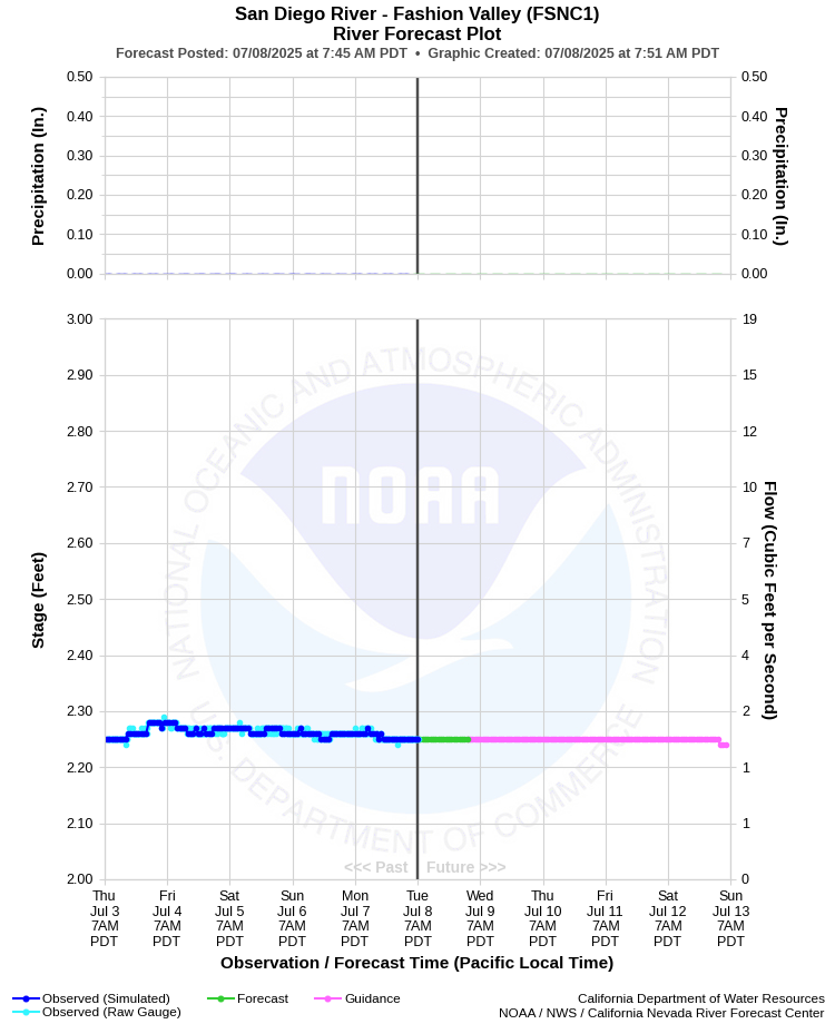
| SAN DIEGO RIVER - FASHION VALLEY (FSNC1) | ||
| Latitude: 32.77º N | Longitude: 117.17º W | Elevation: 20 Feet |
| Location: San Diego County in CA | ||
| River Group: Southern California | ||
| Forecast Issued: | Jul 08 2025 at 7:50 AM PDT | Next Issuance: | Jul 09 2025 at 9:00 AM PDT |
| Action/ Monitor: 7.5 Ft | Minor Flood: 10.0 Ft | Moderate Flood: 13.5 Ft | Major Flood: 16.5 Ft |
Prev. Point | Next Point | Tabular |
Back to Points | Back to Home | Ensemble Fcst |
 |
Historical Stage/Flow Data |
|||
|
Water Year
|
Peak Discharge (cfs)
|
Stage (feet)
|
Date
|
| Most Recent 5 Years | |||
2024 |
2,830 |
11.40 |
Jan 22, 2024 |
2023 |
5,080 |
12.77 |
Jan 16, 2023 |
2022 |
1,370 |
9.40 |
Dec 14, 2021 |
2021 |
691 |
7.26 |
Jan 29, 2021 |
2020 |
4,460 |
12.49 |
Apr 10, 2020 |
| Historical High Stage/Flow Events (Period of Record - Jan 1982 to Present) - Ranked by Flow | |||
2017 |
9,810 |
14.15 |
Feb 28, 2017 |
1995* |
9,430 |
13.47 |
Mar 06, 1995 |
2011* |
9,420 |
14.06 |
Dec 22, 2010 |
1983 |
8,280 |
13.11 |
Mar 02, 1983 |
1998 |
7,090 |
12.80 |
Feb 08, 1998 |
| * Since upstream regulation by El Capitan and San Vicente Reservoirs | |||
| Location Photographs | ||
| ESRI™ Locator Map |
| Flood Impacts | |
| 16.5 Feet | Most unelevated roads and intersections in Mission Valley are flooded and impassable. Widespread damage to businesses, residences and roads throughout Mission Valley. Water will reach up to Highway 163. |
| 13.5 Feet | Portions of Hotel Circle Road North under water. Qualcomm Way flooded and may close. Snapdragon Stadium parking may flood (likely not now) and water may back up on Chollas Creek. Mission Gorge Road at low water crossing closed with 1-2 feet of flowing water. Mission Center Road will have 2-3 feet of flowing water. Hotel Circle Road has areas of standing water. |
| 12.0 Feet | Even more extensive road flooding occurs in and around Mission Valley. Qualcomm Way, Camino Del Este, Ward Road, and Mission Gorge Rd flooded. Mission Trolley Station flooded and may close due to flowing water. I-5 on and off ramps flooded at the San Diego River and Pacific Highway. Mission Center Road may begin flooding with debris on railings. Fashion Valley Trolley Station surrounded by water. 2 feet of water flowing over Fashion Valley Road across gates. Old golf course has been flooded at this level. |
| 11.0 Feet | The parking garages in Fashion Valley Mall can have up to 3 feet of water on the lowest levels. Water may begin to surround area hotels such as the River Leaf Inn. The Mission Trolley Station on Ward Road may begin to flood. Flooding begins on Camino De La Reina (under Highway 163). |
| 10.0 Feet | More extensive flooding begins at this level, more than just low lying areas. Fashion Valley Mall parking garage is taking on water at the lower levels, with 1 to 2 feet of water in the garage. Water on the Town and Country hotel parking lot adjacent to the river and USGS gage. |
| 9.0 Feet | More extensive low lying road flooding begins in and around Fashion Valley including Fashion Valley Road. Parking structures in and around Fashion Valley Mall can begin to take on water at the lowest levels. |
| 7.5 Feet | Action stage. The first real impacts are seen on the San Diego River at this level. Low lying roads in and around Fashion Valley Mall begin to take on water. Avenida Del Rio is the first road to begin flooding. |