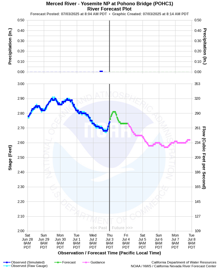
| MERCED RIVER - YOSEMITE NP AT POHONO BRIDGE (POHC1) | ||
| Latitude: 37.72º N | Longitude: 119.67º W | Elevation: 3862 Feet |
| Location: Mariposa County in CA | ||
| River Group: San Joaquin | ||
| Forecast Issued: | Jul 03 2025 at 8:13 AM PDT | Next Issuance: | Jul 04 2025 at 9:00 AM PDT |
| Action/ Monitor: N/A | Minor Flood: 10.0 Ft | Moderate Flood: 12.5 Ft | Major Flood: 20.0 Ft |
Prev. Point | Next Point | Tabular |
Back to Points | Back to Home | Ensemble Fcst |
 |
Historical Stage/Flow Data |
|||
|
Water Year
|
Peak Discharge (cfs)
|
Stage (feet)
|
Date
|
| Most Recent 5 Years | |||
2024 |
5,090 |
8.79 |
May 16, 2024 |
2023 |
9,520 |
12.08 |
May 22, 2023 |
2022 |
4,810 |
8.55 |
Oct 25 2021 |
2021 |
2,160 |
5.92 |
May 6, 2021 |
2020 |
3,560 |
7.41 |
Apr 30, 2020 |
| Historical High Stage/Flow Events (Period of Record - Oct 1916 to Present) - Ranked by Flow | |||
1997 |
24,600 |
23.43 |
Jan 03, 1997 |
1956 |
23,400 |
21.52 |
Dec 23, 1955 |
1951 |
23,000 |
19.98 |
Nov 19, 1950 |
1938 |
22,000 |
19.10 |
Dec 11, 1937 |
1965 |
18,000 |
16.96 |
Dec 23, 1964 |
| Location Photographs | ||
| ESRI™ Locator Map |
| Flood Impacts | |
| 23.45 Feet | Flood of record...1/3/97. $178 million damage to Yosemite Valley. |
| 13.6 Feet | Lift stations at Housekeeping Camp and Yosemite Creek flooded. Southside Drive at Chapel Meadow impassable. |
| 12.5 Feet | Northside Drive at Wosky Pond, El Capitan crossover, and Sentinel crossover are impassable to vehicles. |
| 12.0 Feet | Water on road at Northside Drive, Southside Drive, El Capitan crossover, Sentinel crossover, and Highway 140 near Cookie Cliff. |
| 11.4 Feet | Water begins to overtop road curbs on Northside Drive. Swinging Bridge overtops. |
| 10.0 Feet | Merced River at Pohono Bridge begins to rise out of its banks. Flood Stage. |
| 9.5 Feet | Lower Pines and Housekeeping Camp begin flooding. |
| 7.0 Feet | RIVER IS CLOSED TO RAFTERS AND FLOATATION DEVICES. |