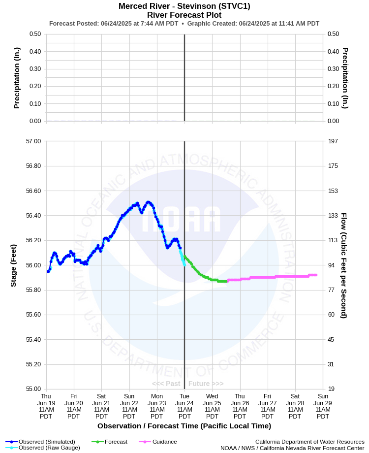
| MERCED RIVER - STEVINSON (STVC1) | ||
| Latitude: 37.37º N | Longitude: 120.93º W | Elevation: 82 Feet |
| Location: Merced County in CA | ||
| River Group: San Joaquin | ||
| Forecast Issued: | Jun 23 2025 at 7:36 AM PDT | Next Issuance: | Jun 24 2025 at 9:00 AM PDT |
| Action/ Monitor: 68.0 Ft | Minor Flood: 71.0 Ft | Moderate Flood: 73.8 Ft | Major Flood: 75.0 Ft |
Prev. Point | Next Point | Tabular |
Back to Points | Back to Home | Ensemble Fcst |
 |
Historical Stage/Flow Data |
|||
|
Water Year
|
Peak Discharge (cfs)
|
Stage (feet)
|
Date
|
| Most Recent 5 Years | |||
2024* |
4,370 |
68.25 |
Mar 5, 2024 |
2023* |
6,010 |
71.44 |
Mar 21, 2023 |
2022* |
863 |
60.77 |
Oct 18, 2021 |
2021* |
604 |
59.42 |
Oct 28, 2020 |
2020* |
2,890 |
65.31 |
Oct 2, 2019 |
| Historical High Stage/Flow Events (Period of Record - 1944 to Present) - Ranked by Flow | |||
1950* |
13,600 |
73.81 |
Dec 05, 1950 |
2017* |
7,540 |
71.63 |
Feb 26, 2017 |
1984 |
7,420 |
70.10 |
Mar 14, 1984 |
1969* |
7,190 |
70.00 |
Jan 25, 1969 |
1967* |
6,510 |
69.40 |
Jul 04, 1967 |
| * Discharge affected by regulation or diversion | |||
| ** Incomplete records | |||
| Location Photographs | ||
| ESRI™ Locator Map |
| Flood Impacts | |
| 70.5 Feet | Water is up to the maintenance building in Hagaman Park. |
| 69.0 Feet | The playground area in Hagaman Park along Highway 165 is flooded. |
| 65.0 Feet | Hagaman Park along Highway 165 begins to flood. |