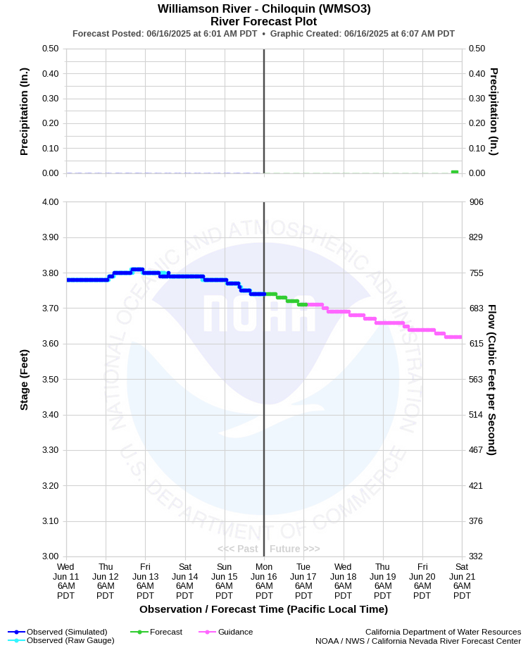
| WILLIAMSON RIVER - CHILOQUIN (WMSO3) | ||
| Latitude: 42.57º N | Longitude: 121.88º W | Elevation: 4149 Feet |
| Location: Klamath County in OR | ||
| River Group: North Coast | ||
| Forecast Issued: | Jun 16 2025 at 6:07 AM PDT | Next Issuance: | Jun 17 2025 at 9:00 AM PDT |
| Action/ Monitor: 8.0 Ft | Minor Flood: 9.0 Ft | Moderate Flood: 10.0 Ft | Major Flood: 11.0 Ft |
Prev. Point | Next Point | Tabular |
Back to Points | Back to Home | Ensemble Fcst |
 |
Historical Stage/Flow Data |
|||
|
Water Year
|
Peak Discharge (cfs)
|
Stage (feet)
|
Date
|
| Most Recent 5 Years | |||
2024 |
1,860 |
5.01 |
Apr 21, 2024 |
2023 |
3,630 |
6.32 |
Apr 16, 2023 |
2022 |
1,040 |
4.16 |
Jan 9, 2022 |
2021 |
670 |
3.68 |
Apr 28, 2021 |
2020 |
1,120 |
4.26 |
Jan 29, 2020 |
| Historical High Stage/Flow Events (Period of Record - April 1917 to Present) - Ranked by Flow | |||
1997 |
17,100 |
10.27 |
Jan 5, 1997 |
| 1964 |
16,100 |
10.56 |
Feb 26, 1964
|
| 1982 |
10,200 |
8.45 |
Feb 24, 1982 |
| 1970 |
8,010 |
7.53 |
Feb 27, 1970
|
| 1943 |
7,660 |
7.29 |
Apr 1, 1943
|
| Location Photographs | ||
| ESRI™ Locator Map |
| Flood Impacts | |
| 10.0 Feet | Widespread flooding is occurring along the Williamson River from the Highway 97 bridge downstream to Upper Klamath Lake. Widespread farm land flooding is occurring. Numerous structures are flooded. |
| 9.0 Feet | The Williamson River is at flood stage. Water exceeds the channel of the river and begins to impact structures along the river and in low-lying areas near the river. |
| 8.0 Feet | The Williamson River is near bankfull stage. Water is nearing many structures along and enar the river. Water is close to structures at the Water Wheel Campground near Highway 97. |