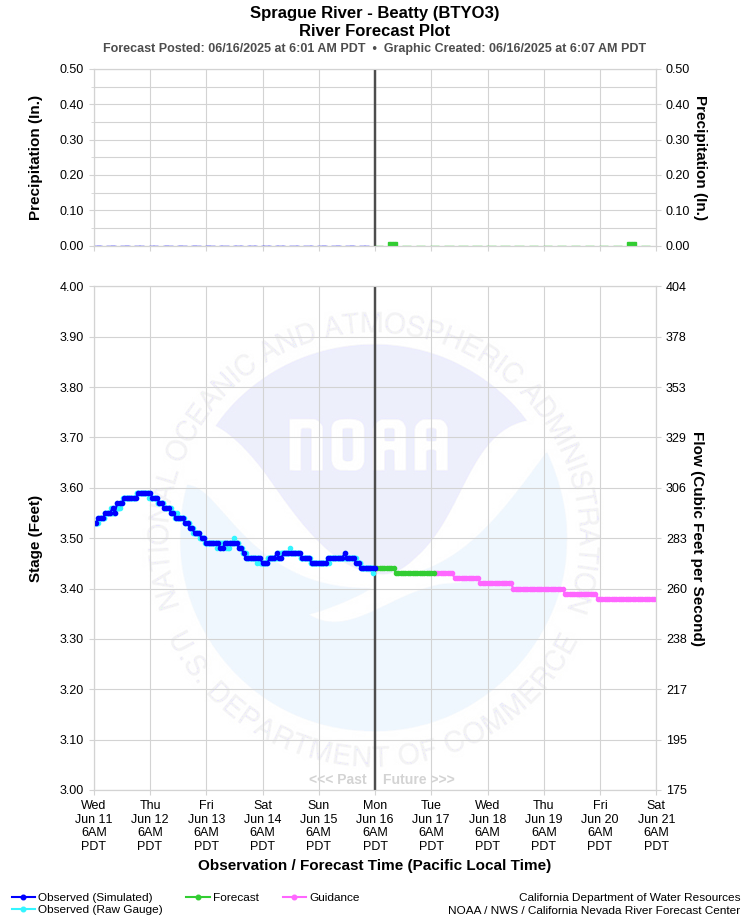
| SPRAGUE RIVER - BEATTY (BTYO3) | ||
| Latitude: 42.45º N | Longitude: 121.24º W | Elevation: 4305 Feet |
| Location: Klamath County in OR | ||
| River Group: North Coast | ||
| Forecast Issued: | Jun 16 2025 at 6:07 AM PDT | Next Issuance: | Jun 17 2025 at 9:00 AM PDT |
| Action/ Monitor: 7.5 Ft | Minor Flood: 8.5 Ft | Moderate Flood: 11.0 Ft | Major Flood: 12.0 Ft |
Prev. Point | Next Point | Tabular |
Back to Points | Back to Home | Ensemble Fcst |
 |
Historical Stage/Flow Data |
|||
|
Water Year
|
Peak Discharge (cfs)
|
Stage (feet)
|
Date
|
| Most Recent 5 Years | |||
2024 |
961 |
5.96 |
May 5, 2024 |
2023 |
1,670 |
7.97 |
Apr 13, 2023 |
2022 |
567 |
5.14 |
Jun 6, 2022 |
2021 |
290 |
3.22 |
Apr 25, 2021 |
2020 |
666 | 5.35 |
Jan 27, 2020 |
| Historical High Stage/Flow Events (Period of Record - Oct 1953 to Present) - Ranked by Flow | |||
| 1965 | 6,980 |
12.19 |
Dec 23, 1964 |
1997 |
6,372 |
11.50 |
Jan 2, 1997
|
1970 |
3,810 |
10.01 |
Jan 24, 1970 |
| 1956 | 3,340 | 9.44 | Dec 23, 1955 |
| 1996 | 3,280 | 9.30 | Feb 8, 1996 |
| Location Photographs | ||
| ESRI™ Locator Map |
| Flood Impacts | |
| 10.0 Feet | Flooding of numerous homes and other structures along the Sprague River is likely. Some relocations and evacuations have taken place at these river stages in the past. |
| 9.0 Feet | Flooding of structures along the Sprague River in the vicinity of Sprague River, Lone Pine, and down stream can be expected. Widespread agricultural flooding is likely in this area as well. |
| 8.0 Feet | Widespread agricultural flooding can be expected downstream in the Sprague River Valley in the vicinity of Sprague River and Lone Pine. |