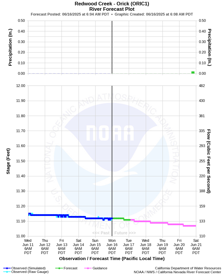
| REDWOOD CREEK - ORICK (ORIC1) | ||
| Latitude: 41.30º N | Longitude: 124.05º W | Elevation: 5 Feet |
| Location: Humboldt County in CA | ||
| River Group: North Coast | ||
| Forecast Issued: | Jun 16 2025 at 6:07 AM PDT | Next Issuance: | Jun 17 2025 at 9:00 AM PDT |
| Action/ Monitor: 26.0 Ft | Minor Flood: 32.0 Ft | Moderate Flood: 35.0 Ft | Major Flood: 37.0 Ft |
Prev. Point | Next Point | Tabular |
Back to Points | Back to Home | Ensemble Fcst |
 |
Historical Stage/Flow Data |
|||
|
Water Year
|
Peak Discharge (cfs)
|
Stage (feet)
|
Date
|
| Most Recent 5 Years | |||
2024 |
42,700 |
30.06 |
Jan 13, 2024 |
2023 |
19,600 |
23.23 |
Dec 31, 2022 |
2022 |
7,890 |
18.12 |
Jan 4, 2022 |
2021 |
8,710 |
18.40 |
Feb 15, 2021 |
2020 |
7,820 | 18.09 |
Jan 26, 2020 |
| Historical High Stage/Flow Events (Period of Record - Oct 1953 to Present)* - Ranked by Flow | |||
1965 |
50,500** |
24.00 |
Dec 22, 1964 |
1975 |
50,200 |
23.82 |
Mar 18, 1975
|
1956 |
50,000** |
23.95 |
Dec 22, 1955 |
| 1953 | 50,000** | 23.95 | Jan 18, 1953 |
| 1972 | 49,700 | 23.67 | Mar 3, 1972 |
| * Most recent continuous record back to Oct 1953 with segmented periods back to Sep 1911 | |||
| ** Old datum. The difference is -0.44 ft and must be applied to data to convert to new datum. | |||
| Location Photographs | ||
| ESRI™ Locator Map |
| Flood Impacts | |
| 38.0 Feet | The river level will be overtopping the levee protecting the town of Orick and adjacent areas. The entire delta area from Prairie Creek downstream to the mouth will be innundated. Travel through the area will be severely restricted with numerous road closures, including US Highway 101. All persons in the area should take appropriate action to protect life and property, and move to higher ground as necessary. |
| 37.0 Feet | The river level is at the top of the levee protecting the town of Orick and adjacent areas. Many roads in the delta area may be flooded and impassable including US Highway 101. All persons in the area should take appropriate action and move to higher ground if necessary. High tides and strong onshore winds will amplify effects. |
| 36.0 Feet | The river is within 1 foot of top of levee. Flooding of some roads in the Orick area is likely. Persons living or working in areas protected by the levee should be prepared to take appropriate action and move to higher ground if necessary. High tides and strong, onshore winds amplify effects. |
| 35.0 Feet | The river is within 2 feet of the top of the levee. Flooding of roads in the Orick area is possible. Persons living or working in areas protected by the levee should be prepared to take appropriate action and move to higher ground if necessary. High tides and strong, onshore winds amplify effects. |