
|
CNRFC Daily Briefing
Last issued: Wed Jul 29, 2026 at 07:20 AM PST (updated daily by 10 AM Pacific Time).
Click image for full-resolution version. 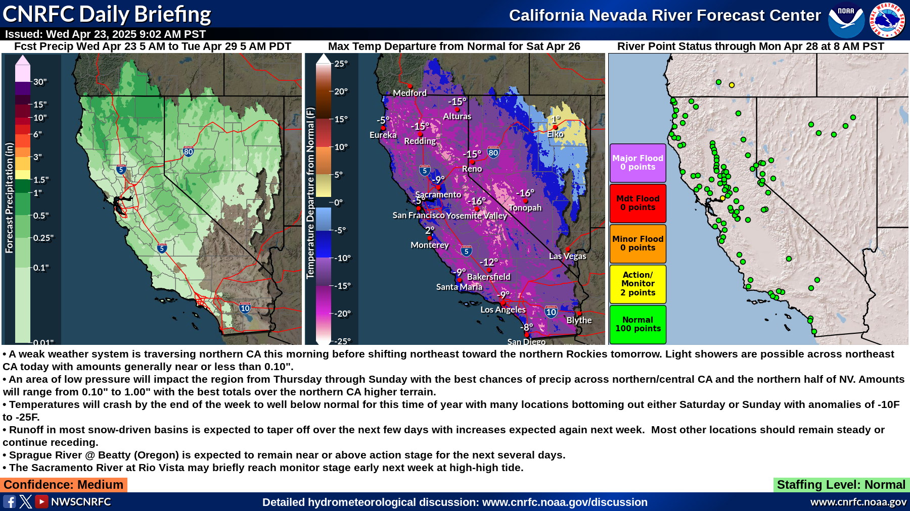
Summary:
Staffing Level: Normal Detailed Hydrometeorological Discussion: www.cnrfc.noaa.gov/discussion |
| River Guidance Points Forecast Above Specified Stage Definitions (Select NWS ID for Specified Graphical RVF) | |||||||||||
| NWS ID | River / Creek | Gage / Station | Action/ Monitor | Minor Flood | Moderate Flood | Major Flood | Latest Observed Stage / Flow | Latest Observed Date / Time | Max Forecast Stage / Flow | ||
*** NO River Guidance (Flood Forecast) Points Currently Forecast At Or Above Critical Stage Definitions *** | |||||||||||
** NOTE ** Stage is presented in "Feet" while Flow (Storage at CLKC1) is presented in "cfs" ("Acre-Feet"). | |||||||||||