
|
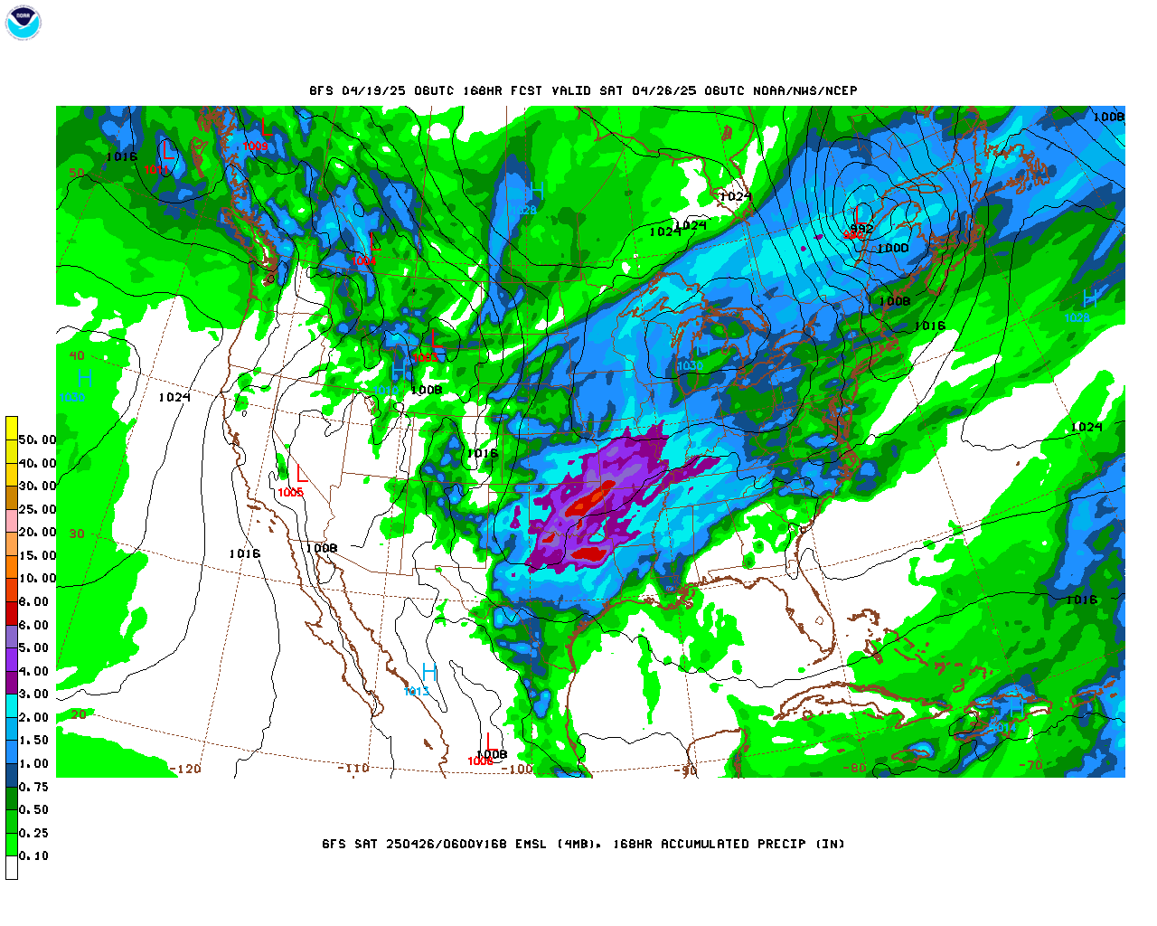
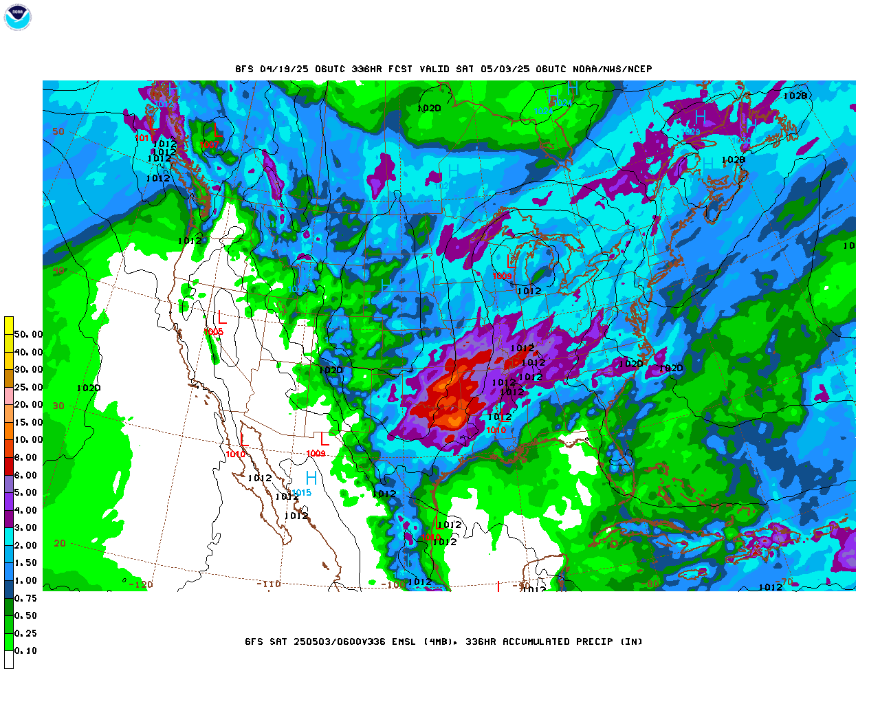
Weather Models NCEP Central Operations' Model Analyses and Guidance webpage features an easy-to-use interface providing access to all NCEP products, including model guidance, observations and analyses, and tropical guidance across several user-selectable domains. The use of Flash-based technology in image loops provides fast loading along with the ability to zoom in and out of static images. Please refer to the sites listed above to view the latest guidance from NCEP. For those unable to access loops utilizing Flash-based technology, the image loops below for the GFS and WRF-NAM models are available. GFS Model The GFS (Global Forecast System) model produces forecasts out to 16 days, four times per day. The loop time steps are 6 hours from analysis time to 240 hours (10 days), then change to 12-hour time steps out to 384 hours (16 days). Map view options include NAmer (North American) and NPacific (North Pacfic).
WRF-NAM Model The WRF-NAM model (Weather and Research Forecast Model - North American Mesoscale) produces forecasts out to 3.5 days, four times per day. The loop time steps are 3 hours from analysis time to 84 hours. Map view options include NAmer (North American) and NPacific (North Pacfic).
WRF-NAM Hi-Res Model The WRF-NAM Hi-Res model (Weather and Research Forecast Model - North American Mesoscale) produces forecasts out to 1.5 days, four times per day. The loop time steps are 3 hours from analysis time to 36 hours. Map view options include CONUS (Contiguous United States).
Other Sources of Model Guidance
Model Output Statistics Forecast Products (Meteorological Development Lab) Short-range GFS MOS (MAV) Meteorological Development Lab Current MOS Forecast Products Main Page |
|||||||||||||||||||||||||||||||||||||||||||||||||||||||||||||||||||||||||||||||||||||||||||||||||||||||||||||||||||||||||||||||||||||||||||||||||||||||||