
|
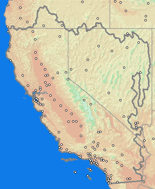
Weather Observations Hourly Weather Collectives Regional METAR Observation Summary METAR Weather Observation Map METAR is the international standard code format for hourly surface weather observations, which includes data on sky condition and weather, visibility, temperature and dewpoint temperature, wind direction and speed, station pressure, etc. The METAR observations are taken by automated weather observing equipment known as ASOS. Selecting a location on the map will display the latest 48 hours of observations.
Alternative Text Menu of METAR Weather Observations Select from the pull-down list of METAR sites below. Manual METAR Selection Select location from METAR locations anywhere in the U.S. Coastal Weather Observations
Hourly Buoy and Coastal Reports - Pacific Ocean Coastline Profiler Data NOAA / PSL Profiler Network Data and Image Library Surface Weather Plots Oregon,
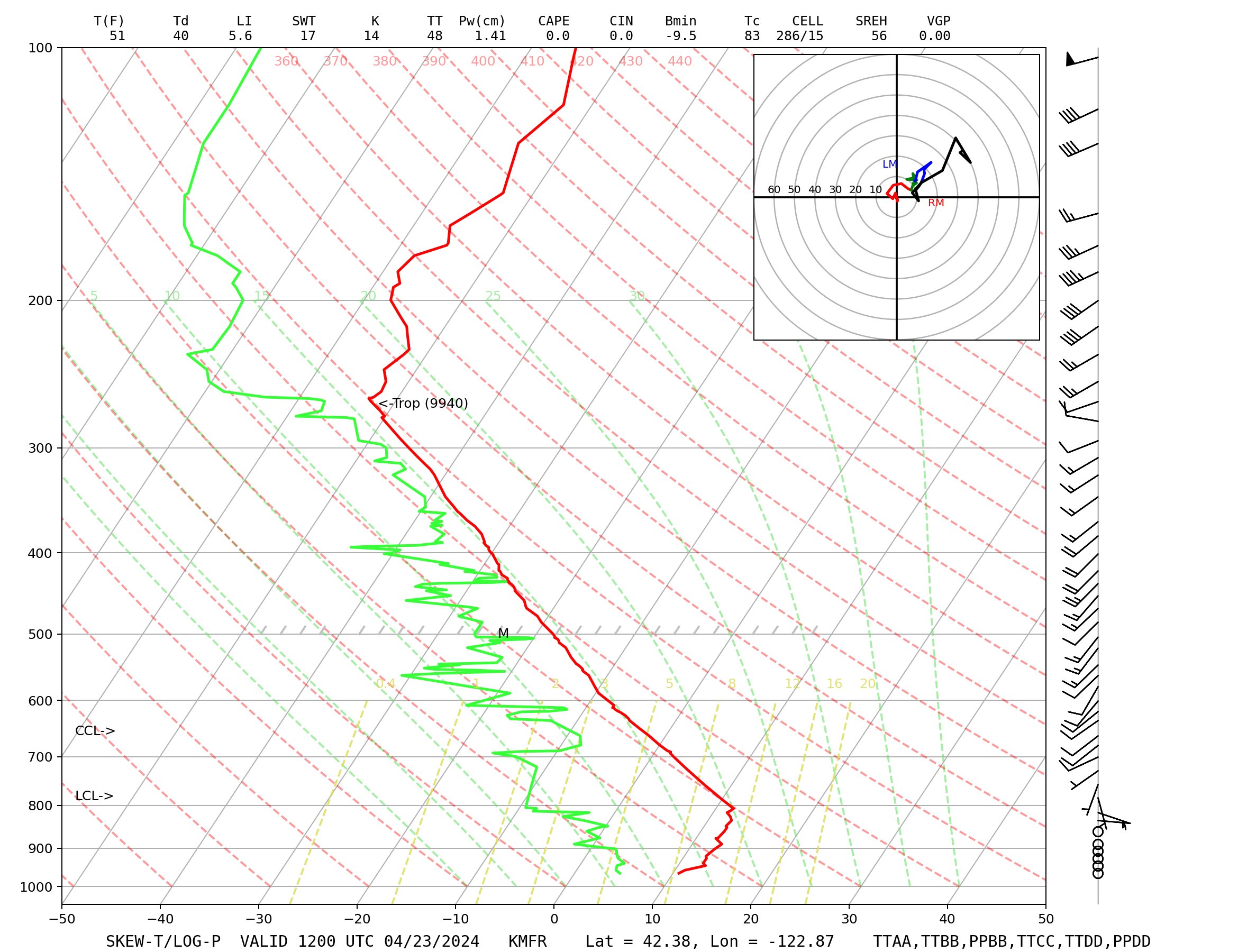
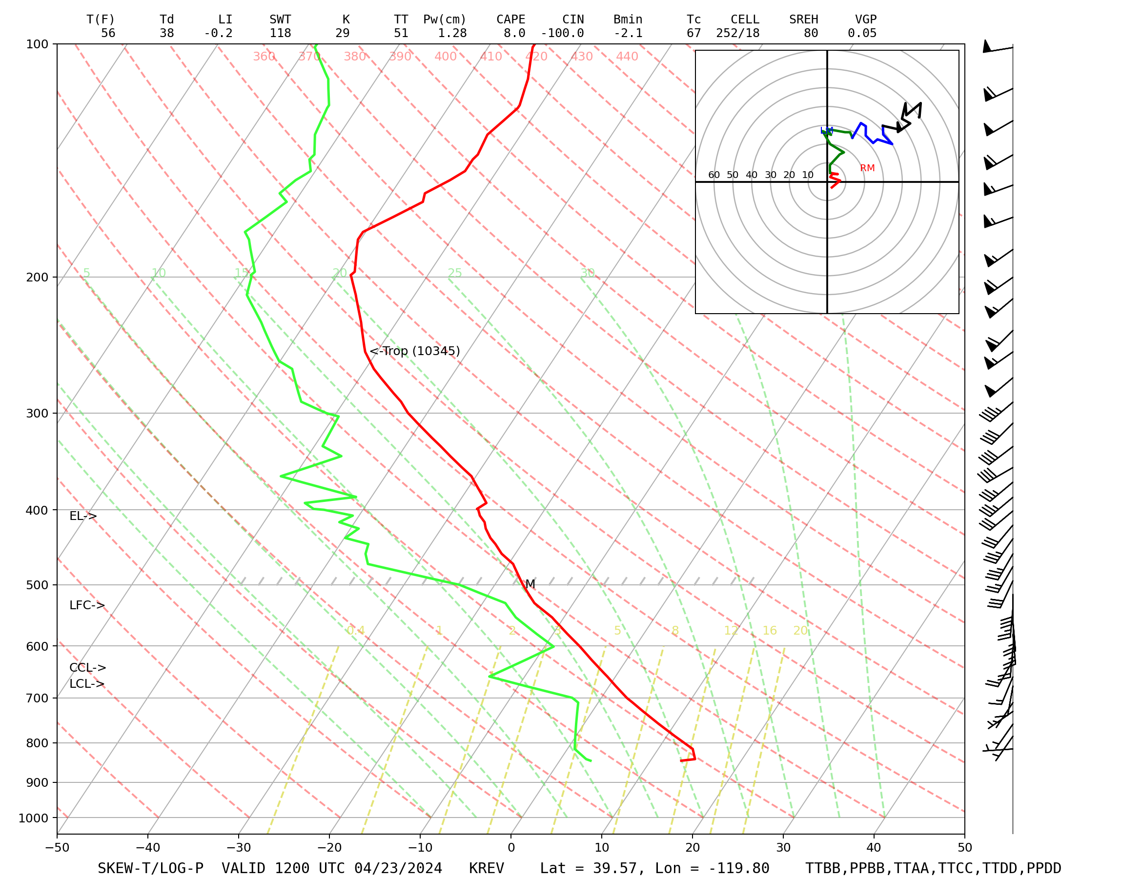
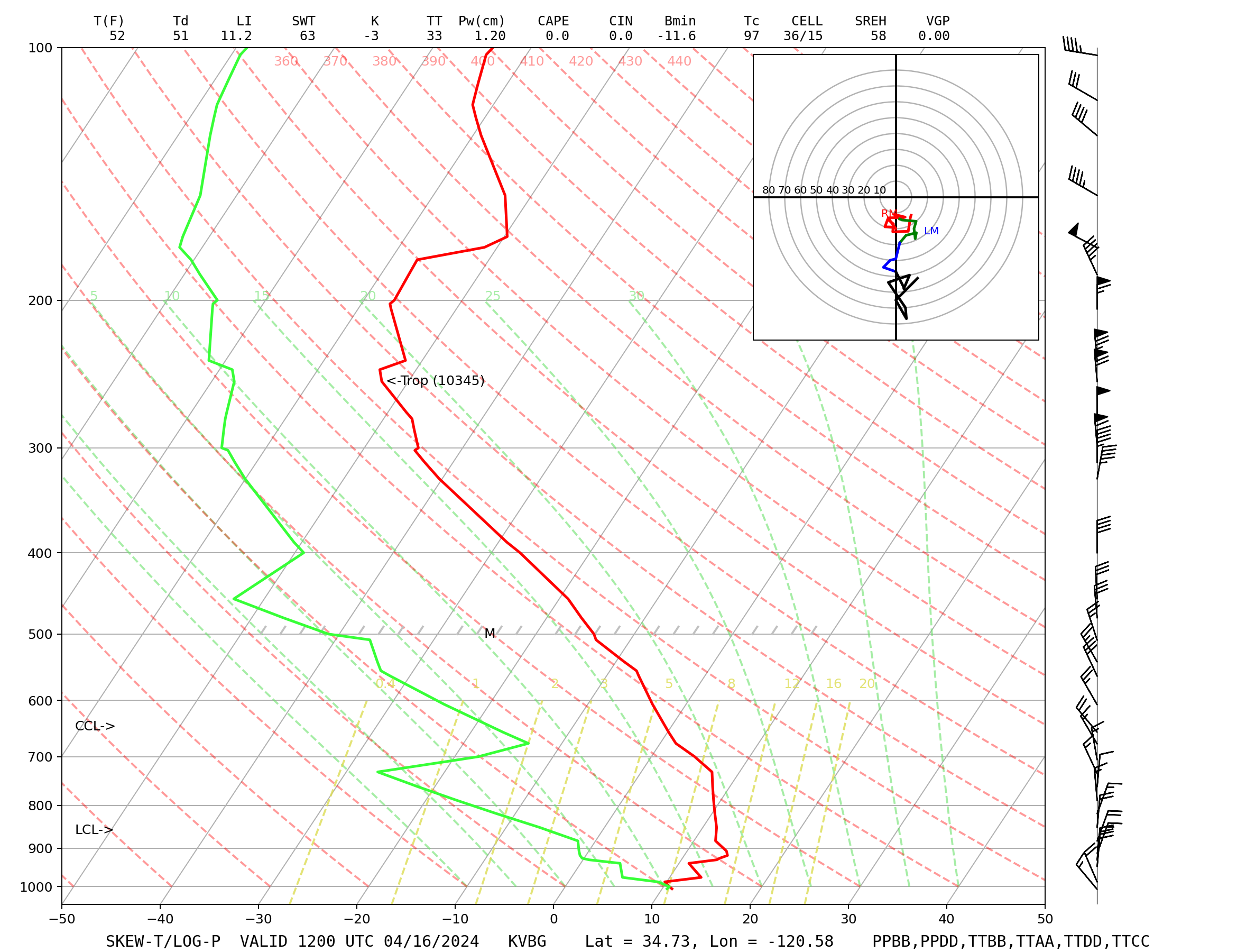
Northern California, and Nevada Upper Air Soundings
|