| Back to Ensemble Products Map |
|
<<< Previous Ensemble Location (JNSC1) | Next Ensemble Location (DMCC1) >>> |
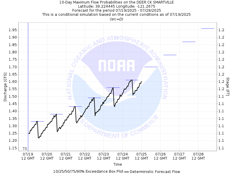
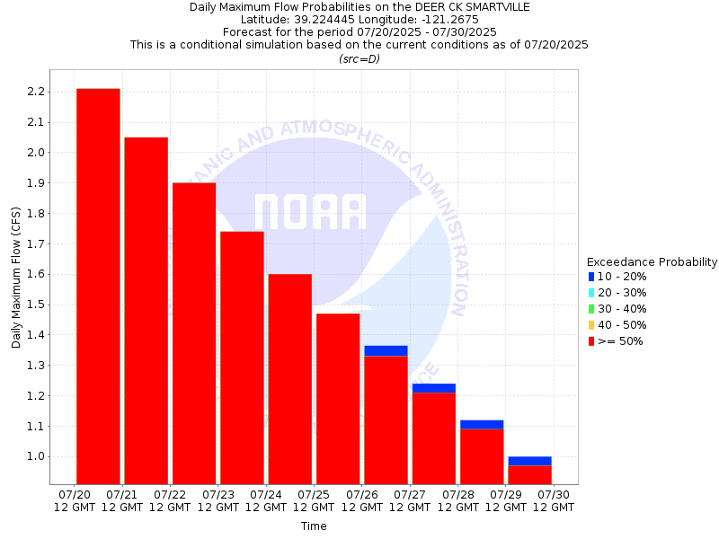
DEER CREEK - SMARTSVILLE (DCSC1)
| Latitude: 39.22º N | Longitude: 121.27º W | Elevation: 630 Feet | | | |
| Location: Nevada County in California | Bulletin Group: Lower Sacramento | River Group: Feather Yuba |
| Issuance Time: | Jul 18, 2025 at 7:13 AM PDT |
| Please Note: | Ensemble forecasts produced by CNRFC only consider meteorological uncertainty and do not account for hydrologic uncertainty. |
| Official 7 Day National Weather Service Forecast (CAZ067) |
Tonight: Clear. Lows 57 to 67. Prevailing west winds up to 10 mph in the evening becoming light.
Saturday: Sunny. Highs 85 to 95. Light winds becoming west up to 10 mph in the afternoon.
Saturday Night: Clear. Lows 57 to 67. Prevailing west winds up to 10 mph in the evening becoming light.
Sunday: Sunny. Highs 84 to 94. Light winds becoming southwest up to 10 mph in the afternoon.
Sunday Night: Clear. Lows 56 to 66. Prevailing southwest winds up to 10 mph in the evening becoming light.
Monday: Sunny. Highs 78 to 88.
Monday Night: Clear. Lows 53 to 61.
Tuesday through Friday: Clear. Highs 76 to 87. Lows 52 to 62. |
