Auburn Cofferdam Photos - February 1986
All of the images in the slideshow below appeared in a presentation entitled "Dams and Disasters: A brief overview of dam building triumphs and tragedies in California's past", authored by J. David Rogers and Karl Hasselmann, University of Missouri-Rolla. Images 2, 3, and 4 were taken by Robert Christopherson.
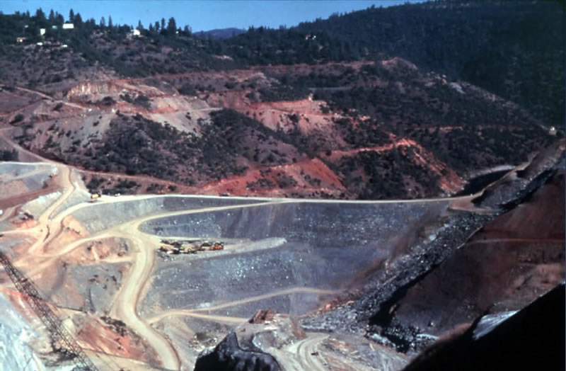
Photo of the Auburn earthfill cofferdam during construction
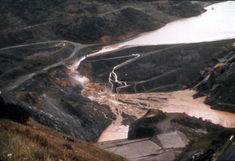
Photo of the initial overtopping of the Auburn cofferdam at 9AM PST on the 18th of February
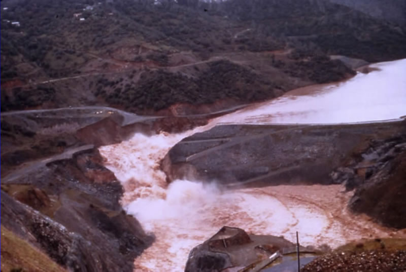
Photo of the breaching of the Auburn cofferdam when outflow exceeded 100,000 cfs at 12:00 PM PST on the 18th of February
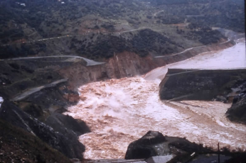
Photo taken of the Auburn cofferdam in the early afternoon of the 18th when flow peaked around 250,000 cfs with a depth of 50 feet
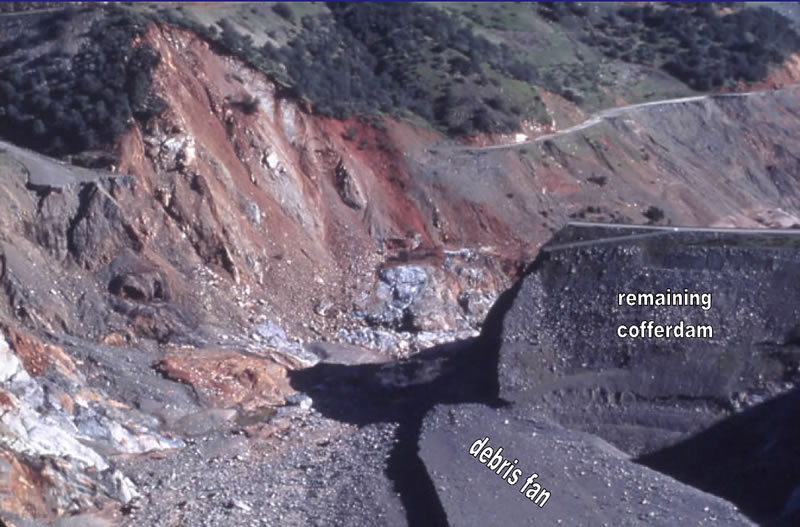
Photo of the remains of Auburn cofferdam. Two million cubic yards of material were swept downstream into Folsom Lake. The force of the moving water through the breach excavated the riverbed 25 feet below the original cofferdam foundation, down to underlying metamorphic rock. |