National Weather Service California Nevada River Forecast Center Department of Commerce National Oceanic and Atmospheric Administration National Weather Service

*** IMPORTANT ***  Week of June 16 - Website Data Outage - Due to a major computer upgrade the week of June 16, nearly all data on the CNRFC web site will not be updated. We anticipate the down time to be approximately 4 days. The latest deterministic hydrologic forecasts for official forecast points will continue to be available at the National Water Prediction Service during this time.
SACRAMENTO RIVER - RIO VISTA (RVBC1)
Latitude: 38.16º NLongitude: 121.69º WElevation: 0 Feet
Location: Solano County in CaliforniaBulletin Group: Lower SacramentoRiver Group: Lower Sacramento
Action/Monitor: 7.4 FeetMinor Flood: 11.9 FeetModerate Flood: 20.4 FeetMajor Flood: 21.4 Feet

Downstream Photograph - June 19, 2006 (Stage 5.8 Feet)
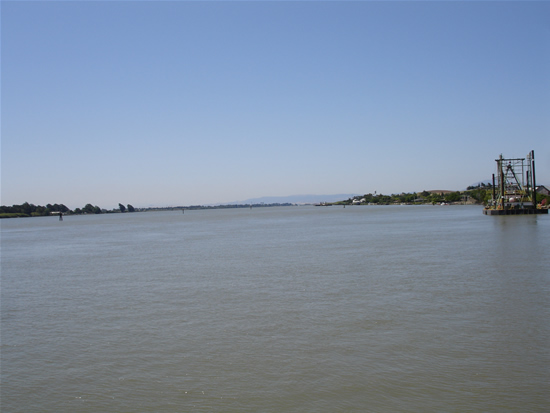
DOWNSTREAM PHOTOGRAPH - SACRAMENTO RIVER - RIO VISTA (RVBC1)
Location Photographs
Downstream Photo
* Photograph Credit - The National Weather Service (NWS)

Go to Graphical River Guidance for: RVBC1  Return to Graphical River Guidance for: RVBC1