National Weather Service California Nevada River Forecast Center Department of Commerce National Oceanic and Atmospheric Administration National Weather Service

CNRFC Interactive Map Interface
Download map as PNG image.  Toggle data table on/off.  Expand or shrink map.    Permalink      
Geographic
Overlays
    2023    2022    2021
 

Topography

Topography/USGS

ESRI Topography

Shaded Relief

Imagery

Nat'l Geographic

Topo/Rivers

Topo/Hydro

Light Gray
 
The number inside each circle above represents the number of gages with observed conditions inside that category.
The number inside each circle above represents the number of gages with forecast conditions inside that category.
The number inside each circle above/below represents the number of gages with conditions inside that category.
Forecast
(large dots)
The number inside each circle above represents the number of gages with observed conditions inside that category.
The number inside each circle above represents the number of gages with forecast conditions inside that category.
The number inside each circle above/below represents the number of gages with conditions inside that category.
Observed
(small dots)


KML logoDownload Overlay Files Download Overlay Shapefiles


Rivers/Reservoirs

Deterministic 5-Day Forecasts 

Data updated:

Ensemble Forecasts
Data updated:


Peak Exceedance Probabilities*
Data updated:
10%25%50%75%90%
5-Day Peak
10-Day Peak
*Exceedance probabilities are only available for selected forecast points.

Observed Data
Data updated:

Latest Hour 1 Hr Ago 2 Hrs Ago 3 Hrs Ago
Forecast Points
Other Points
Reservoirs

Deterministic Forecast + Observed Data
Fcst data updated:
Obs data updated:
Forecast Points 
Link to


Significant River Flood Outlook
Data updated:
Valid:

      National Significant River Flood Outlook

Water Resources

Data updated (unless otherwise noted):


Monthly Archive
Month/Year:     

Reservoir Storage
(Data to 1925 for all reservoirs/1951 for "major")
% Normal % Capacity

Snow Data

National Gridded Data


Select date:     To:

Point Data
Data updated:
SWE
SWE Change


Data updated:
Snow Depth
Snow Depth Change

Daily Archive (Data back to Apr 2014)
M/D/Y:     
  Basin Elevation Zones % Avg % Apr 1
Avg
Value
Simulated
Basin
Avg
Middle/Upper
Lower/Only
All Zones

Monthly Archive (Data back to Jan 1998)
Month/Year:     
  % Avg Value
Point*
* Jan-Jun only prior to 2019.

Observed Precipitation (QPE)

Radar Data


Select radar time:  


Short-Range Point Data

Raw data updated:
QC data updated:   
Most Recent Hours (Raw):


6-Hour Totals (QC'd = Quality-Controlled)
Ending 18Z (11 AM PDT) Ending 00Z (5 PM PDT) Ending 06Z (11 PM PDT) Ending 12Z (5 AM PDT)


24-Hour Totals (QC'd = Quality-Controlled)


Short-Range Gridded Data
Images created:


Monthly/Water Year Archive (starts Oct 1996)
Month/Year:     
Note: The water year starts on October 1 of the previous reference year and ends on September 30 of the reference year. For example, the 2020 Water Year began on October 1, 2019 and ended on September 30, 2020.
    % Avg Value Departure Avg
Point Month
   
WY
   
Grid Month
WY
Basin
Avg
Month
     
WY
     
Forecast
Group
WY


 From Water Year:   to: 

Forecast Precipitation (QPF)

CNRFC Forecast Data
Forecast issued:


Select forecast time:  


Select forecast time:  


WPC Forecast Data
Day 1 issued:
Day 2 issued:
Day 3 issued:
Days 1-3 issued:
Days 1-7 issued:
WPC 6-Hourly QPF
Select forecast time:  


WPC 24-Hourly QPF
Select forecast time:  


WPC 72-Hourly QPF

WPC 7-Day QPF

Observed Temperatures

Point Data
Data updated:
QC data updated:
Instantaneous Temperatures
Temp Change:
Max/Min Temperatures
24-Hour Max
Ending 12Z
(5 AM PDT)
24-Hour Min
Ending 12Z
(5 AM PDT)
Daytime
Max *
Overnight
Min **
* Updated: 10 PM   **Updated: 10 AM  

Gridded Data
Images created:


Select obs time:  


Forecast Temperatures

Basin Temperature Plots
Images created:


Forecast Temperature Grids
Images created:


Freezing Levels

Observed Freezing Levels
Images created:
  

Select forecast time:  


Forecast Freezing Levels
Forecast issued:
  

Select forecast time:  


Flash Flood Guidance/Debris Flow

Flash Flood Guidance Grids
Images created:


Note: Recent burn areas are typically more vulnerable to flash flooding and debris flows. Check with your local NWS Forecast Office for fire specific guidance.

Post-Wildfire Debris-Flow Basin Probability
Debris Flow Probability (peak 15-min rainfall intensity of 24 mm/hr)

More info: USGS post-wildfire debris-flow hazards

Water Temperatures

Data updated:


Climate/Drought

U.S. Drought Monitor

Select issuance date range:

From:     To:

Climate Prediction Center Outlooks
Drought Outlooks
Extended Range Outlooks
Precipitation
Temperatures
Long Lead Outlook
Precipitation
Temperatures

QPF Verification

24-Hour QPF Verification Grids
Images created:
Date: (ending 4am PST / 5am PDT) Select forecast to verify:
Day 1 forecast created Mon Mar 18, 2024


    QPE    
QPF

Watches/Warnings/Advisories

Last updated:
 

Mid-Atlantic RFCOhio RFCNortheast RFCNorth-Central RFCMissouri Basin RFCLower Mississippi RFCWest Gulf RFCArkansas-Red Basin RFCSoutheast RFCNorthwest RFCColorado Basin RFCCalifornia-Nevada RFCAlaska-Pacific RFCMap showing all 13 RFCs
Disclaimer

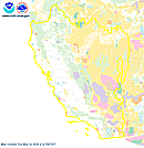
This image is currently not available. Please try again later.

The selected data is currently not available. Please check again later.

The "Download PNG" feature is not available in this browser. Please try a different browser.

Load a point data set to view data.


Note:

Please select a data type above to activate KML download section.

Feedback / Comments:

Email the CNRFC Webmaster with your feedback and comments.